You are here: Home > Network List > UW - Pacific Northwest Regional Seismic Network Stations List
> Station MRBL Marblemount, WA, USA > Earthquake Result Viewer
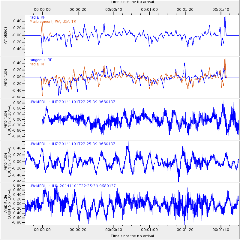
MRBL Marblemount, WA, USA - Earthquake Result Viewer
*The percent match for this event was below the threshold and hence no stack was calculated.
| Earthquake location: |
Solomon Islands |
| Earthquake latitude/longitude: |
-9.8/159.8 |
| Earthquake time(UTC): |
2014/11/01 (305) 22:13:14 GMT |
| Earthquake Depth: |
26 km |
| Earthquake Magnitude: |
5.6 mb, 5.6 mb, 5.2 MS |
| Earthquake Catalog/Contributor: |
ISC/ISC |
|
| Network: |
UW Pacific Northwest Regional Seismic Network |
| Station: |
MRBL Marblemount, WA, USA |
| Lat/Lon: |
48.52 N/121.48 W |
| Elevation: |
75 m |
|
| Distance: |
89.9 deg |
| Az: |
40.7 deg |
| Baz: |
255.156 deg |
| Ray Param: |
$rayparam |
*The percent match for this event was below the threshold and hence was not used in the summary stack. |
|
| Radial Match: |
43.09895 % |
| Radial Bump: |
400 |
| Transverse Match: |
45.647175 % |
| Transverse Bump: |
378 |
| SOD ConfigId: |
3390531 |
| Insert Time: |
2019-04-14 19:59:49.954 +0000 |
| GWidth: |
2.5 |
| Max Bumps: |
400 |
| Tol: |
0.001 |
|
Signal To Noise
| Channel | StoN | STA | LTA |
| UW:MRBL: :HHZ:20141101T22:25:39.968013Z | 1.9982938 | 2.1488623E-7 | 1.0753486E-7 |
| UW:MRBL: :HHN:20141101T22:25:39.968013Z | 2.2342865 | 4.4046234E-7 | 1.9713781E-7 |
| UW:MRBL: :HHE:20141101T22:25:39.968013Z | 2.340341 | 4.3067845E-7 | 1.840238E-7 |
| Arrivals |
| Ps | |
| PpPs | |
| PsPs/PpSs | |


