You are here: Home > Network List > IW - Intermountain West Stations List
> Station MOOW Moose Ponds, Wyoming, USA > Earthquake Result Viewer
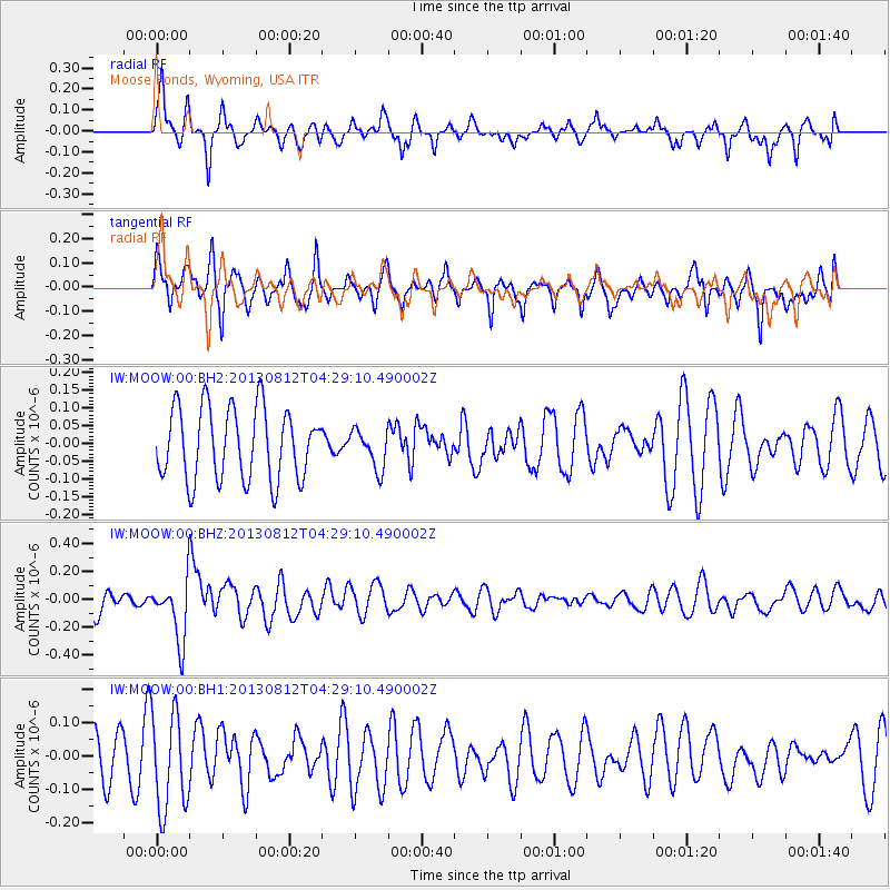
MOOW Moose Ponds, Wyoming, USA - Earthquake Result Viewer
*The percent match for this event was below the threshold and hence no stack was calculated.
| Earthquake location: |
Kermadec Islands Region |
| Earthquake latitude/longitude: |
-30.6/-179.7 |
| Earthquake time(UTC): |
2013/08/12 (224) 04:16:47 GMT |
| Earthquake Depth: |
341 km |
| Earthquake Magnitude: |
6.1 MWW, 6.1 MWC, 6.2 MWC, 6.2 MWB |
| Earthquake Catalog/Contributor: |
NEIC PDE/NEIC COMCAT |
|
| Network: |
IW Intermountain West |
| Station: |
MOOW Moose Ponds, Wyoming, USA |
| Lat/Lon: |
43.75 N/110.74 W |
| Elevation: |
2128 m |
|
| Distance: |
97.2 deg |
| Az: |
42.968 deg |
| Baz: |
234.165 deg |
| Ray Param: |
$rayparam |
*The percent match for this event was below the threshold and hence was not used in the summary stack. |
|
| Radial Match: |
57.927223 % |
| Radial Bump: |
365 |
| Transverse Match: |
69.83617 % |
| Transverse Bump: |
385 |
| SOD ConfigId: |
626651 |
| Insert Time: |
2014-04-17 21:54:32.585 +0000 |
| GWidth: |
2.5 |
| Max Bumps: |
400 |
| Tol: |
0.001 |
|
Signal To Noise
| Channel | StoN | STA | LTA |
| IW:MOOW:00:BHZ:20130812T04:29:10.490002Z | 2.2466564 | 2.1746851E-7 | 9.679651E-8 |
| IW:MOOW:00:BH1:20130812T04:29:10.490002Z | 2.6623294 | 1.4672972E-7 | 5.511328E-8 |
| IW:MOOW:00:BH2:20130812T04:29:10.490002Z | 0.53212607 | 5.4266778E-8 | 1.0198105E-7 |
| Arrivals |
| Ps | |
| PpPs | |
| PsPs/PpSs | |


