You are here: Home > Network List > TA - USArray Transportable Network (new EarthScope stations) Stations List
> Station O03E Paynes Creek, CA, USA > Earthquake Result Viewer
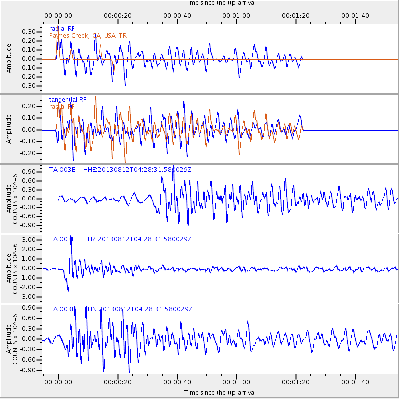
O03E Paynes Creek, CA, USA - Earthquake Result Viewer
*The percent match for this event was below the threshold and hence no stack was calculated.
| Earthquake location: |
Kermadec Islands Region |
| Earthquake latitude/longitude: |
-30.6/-179.7 |
| Earthquake time(UTC): |
2013/08/12 (224) 04:16:47 GMT |
| Earthquake Depth: |
341 km |
| Earthquake Magnitude: |
6.1 MWW, 6.1 MWC, 6.2 MWC, 6.2 MWB |
| Earthquake Catalog/Contributor: |
NEIC PDE/NEIC COMCAT |
|
| Network: |
TA USArray Transportable Network (new EarthScope stations) |
| Station: |
O03E Paynes Creek, CA, USA |
| Lat/Lon: |
40.29 N/121.80 W |
| Elevation: |
967 m |
|
| Distance: |
88.6 deg |
| Az: |
40.387 deg |
| Baz: |
226.905 deg |
| Ray Param: |
$rayparam |
*The percent match for this event was below the threshold and hence was not used in the summary stack. |
|
| Radial Match: |
75.08982 % |
| Radial Bump: |
400 |
| Transverse Match: |
78.86488 % |
| Transverse Bump: |
400 |
| SOD ConfigId: |
626651 |
| Insert Time: |
2014-04-17 22:00:45.889 +0000 |
| GWidth: |
2.5 |
| Max Bumps: |
400 |
| Tol: |
0.001 |
|
Signal To Noise
| Channel | StoN | STA | LTA |
| TA:O03E: :HHZ:20130812T04:28:31.580029Z | 17.203234 | 1.2609611E-6 | 7.329791E-8 |
| TA:O03E: :HHN:20130812T04:28:31.580029Z | 4.5406685 | 2.1440904E-7 | 4.7219707E-8 |
| TA:O03E: :HHE:20130812T04:28:31.580029Z | 3.7363412 | 2.68742E-7 | 7.192652E-8 |
| Arrivals |
| Ps | |
| PpPs | |
| PsPs/PpSs | |


