You are here: Home > Network List > UW - Pacific Northwest Regional Seismic Network Stations List
> Station BLOW Detroit Lake, OR, USA > Earthquake Result Viewer
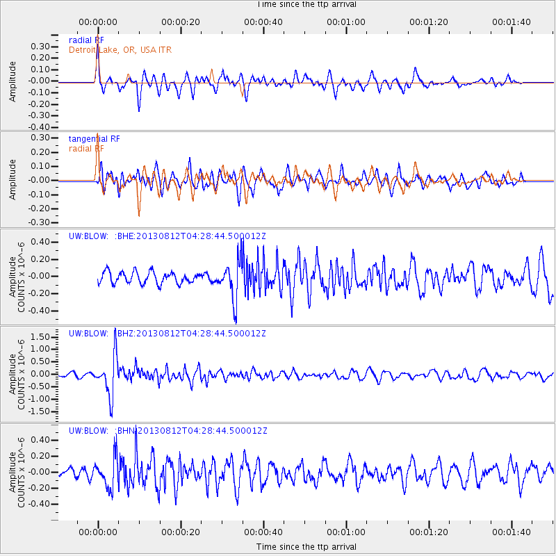
BLOW Detroit Lake, OR, USA - Earthquake Result Viewer
*The percent match for this event was below the threshold and hence no stack was calculated.
| Earthquake location: |
Kermadec Islands Region |
| Earthquake latitude/longitude: |
-30.6/-179.7 |
| Earthquake time(UTC): |
2013/08/12 (224) 04:16:47 GMT |
| Earthquake Depth: |
341 km |
| Earthquake Magnitude: |
6.1 MWW, 6.1 MWC, 6.2 MWC, 6.2 MWB |
| Earthquake Catalog/Contributor: |
NEIC PDE/NEIC COMCAT |
|
| Network: |
UW Pacific Northwest Regional Seismic Network |
| Station: |
BLOW Detroit Lake, OR, USA |
| Lat/Lon: |
44.68 N/122.19 W |
| Elevation: |
652 m |
|
| Distance: |
91.4 deg |
| Az: |
36.997 deg |
| Baz: |
226.648 deg |
| Ray Param: |
$rayparam |
*The percent match for this event was below the threshold and hence was not used in the summary stack. |
|
| Radial Match: |
63.879486 % |
| Radial Bump: |
352 |
| Transverse Match: |
66.52826 % |
| Transverse Bump: |
400 |
| SOD ConfigId: |
626651 |
| Insert Time: |
2014-04-17 22:04:29.875 +0000 |
| GWidth: |
2.5 |
| Max Bumps: |
400 |
| Tol: |
0.001 |
|
Signal To Noise
| Channel | StoN | STA | LTA |
| UW:BLOW: :BHZ:20130812T04:28:44.500012Z | 10.100146 | 8.2580584E-7 | 8.176177E-8 |
| UW:BLOW: :BHN:20130812T04:28:44.500012Z | 2.6230192 | 1.8922019E-7 | 7.213832E-8 |
| UW:BLOW: :BHE:20130812T04:28:44.500012Z | 3.4729025 | 2.2899428E-7 | 6.593743E-8 |
| Arrivals |
| Ps | |
| PpPs | |
| PsPs/PpSs | |


