You are here: Home > Network List > UW - Pacific Northwest Regional Seismic Network Stations List
> Station MRBL Marblemount, WA, USA > Earthquake Result Viewer
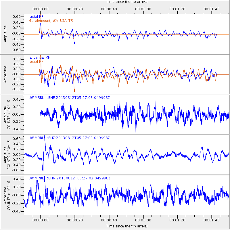
MRBL Marblemount, WA, USA - Earthquake Result Viewer
*The percent match for this event was below the threshold and hence no stack was calculated.
| Earthquake location: |
Off Coast Of Costa Rica |
| Earthquake latitude/longitude: |
10.5/-86.9 |
| Earthquake time(UTC): |
2013/08/12 (224) 05:18:59 GMT |
| Earthquake Depth: |
22 km |
| Earthquake Magnitude: |
5.5 MW, 5.5 MWC, 5.5 MWC |
| Earthquake Catalog/Contributor: |
NEIC PDE/NEIC COMCAT |
|
| Network: |
UW Pacific Northwest Regional Seismic Network |
| Station: |
MRBL Marblemount, WA, USA |
| Lat/Lon: |
48.52 N/121.48 W |
| Elevation: |
75 m |
|
| Distance: |
47.7 deg |
| Az: |
329.336 deg |
| Baz: |
131.02 deg |
| Ray Param: |
$rayparam |
*The percent match for this event was below the threshold and hence was not used in the summary stack. |
|
| Radial Match: |
49.21941 % |
| Radial Bump: |
400 |
| Transverse Match: |
62.86933 % |
| Transverse Bump: |
400 |
| SOD ConfigId: |
626651 |
| Insert Time: |
2014-04-17 22:46:14.315 +0000 |
| GWidth: |
2.5 |
| Max Bumps: |
400 |
| Tol: |
0.001 |
|
Signal To Noise
| Channel | StoN | STA | LTA |
| UW:MRBL: :BHZ:20130812T05:27:03.049998Z | 4.8511825 | 3.088956E-7 | 6.367429E-8 |
| UW:MRBL: :BHN:20130812T05:27:03.049998Z | 1.725309 | 1.8463197E-7 | 1.0701386E-7 |
| UW:MRBL: :BHE:20130812T05:27:03.049998Z | 0.68316346 | 7.887381E-8 | 1.15453794E-7 |
| Arrivals |
| Ps | |
| PpPs | |
| PsPs/PpSs | |


