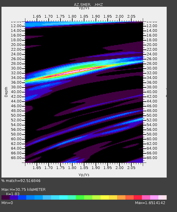
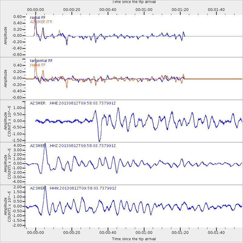
SMER AZ.SMER - Earthquake Result Viewer

Earthquake location: Near Coast Of Northern Peru
Earthquake latitude/longitude: -5.4/-81.9
Earthquake time(UTC): 2013/08/12 (224) 09:49:32 GMT
Earthquake Depth: 10 km
Earthquake Magnitude: 6.2 MWW, 6.1 MWB, 6.2 MWW, 6.2 MWC, 6.3 MWC
Earthquake Catalog/Contributor: NEIC PDE/NEIC COMCAT
Network: AZ ANZA Regional Network
Station: SMER AZ.SMER
Lat/Lon: 33.46 N/117.17 W
Elevation: 355 m
Distance: 51.1 deg
Az: 321.667 deg
Baz: 132.382 deg
Ray Param: 0.06765036
Estimated Moho Depth: 30.75 km
Estimated Crust Vp/Vs: 1.83
Assumed Crust Vp: 6.264 km/s
Estimated Crust Vs: 3.423 km/s
Estimated Crust Poisson's Ratio: 0.29
Radial Match: 92.516846 %
Radial Bump: 341
Transverse Match: 61.460545 %
Transverse Bump: 400
SOD ConfigId: 626651
Insert Time: 2014-04-17 22:57:48.761 +0000
GWidth: 2.5
Max Bumps: 400
Tol: 0.001

Signal To Noise

ChannelStoNSTALTA
AZ:SMER: :HHZ:20130812T09:58:03.737991Z16.2856791.2841481E-67.8851365E-8
AZ:SMER: :HHN:20130812T09:58:03.737991Z4.49229965.140678E-71.1443311E-7
AZ:SMER: :HHE:20130812T09:58:03.737991Z6.5531644.117591E-76.2833635E-8
Arrivals
Ps4.3 SECOND
PpPs13 SECOND
PsPs/PpSs17 SECOND