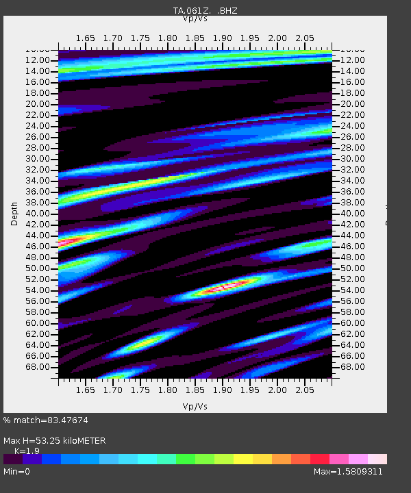
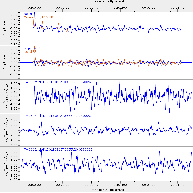
061Z Ochoppi, FL, USA - Earthquake Result Viewer

Earthquake location: Near Coast Of Northern Peru
Earthquake latitude/longitude: -5.4/-81.9
Earthquake time(UTC): 2013/08/12 (224) 09:49:32 GMT
Earthquake Depth: 10 km
Earthquake Magnitude: 6.2 MWW, 6.1 MWB, 6.2 MWW, 6.2 MWC, 6.3 MWC
Earthquake Catalog/Contributor: NEIC PDE/NEIC COMCAT
Network: TA USArray Transportable Network (new EarthScope stations)
Station: 061Z Ochoppi, FL, USA
Lat/Lon: 25.87 N/80.91 W
Elevation: 9.0 m
Distance: 31.1 deg
Az: 1.779 deg
Baz: 181.966 deg
Ray Param: 0.07916052
Estimated Moho Depth: 53.25 km
Estimated Crust Vp/Vs: 1.90
Assumed Crust Vp: 5.78 km/s
Estimated Crust Vs: 3.042 km/s
Estimated Crust Poisson's Ratio: 0.31
Radial Match: 83.47674 %
Radial Bump: 400
Transverse Match: 61.315475 %
Transverse Bump: 400
SOD ConfigId: 626651
Insert Time: 2014-04-17 23:17:35.104 +0000
GWidth: 2.5
Max Bumps: 400
Tol: 0.001

Signal To Noise

ChannelStoNSTALTA
TA:061Z: :BHZ:20130812T09:55:20.025009Z7.70034362.4028143E-63.1203987E-7
TA:061Z: :BHN:20130812T09:55:20.025009Z2.49250151.5426697E-66.189243E-7
TA:061Z: :BHE:20130812T09:55:20.025009Z1.12677945.4907315E-74.8729424E-7
Arrivals
Ps8.8 SECOND
PpPs25 SECOND
PsPs/PpSs34 SECOND