153A Fort Valley, GA, USA - Earthquake Result Viewer
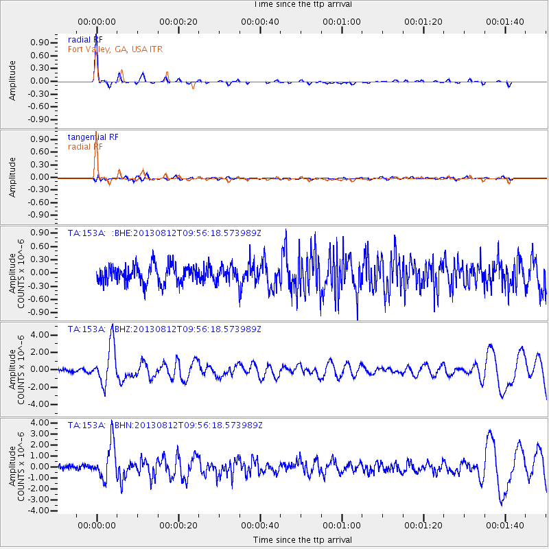
Earthquake location: Near Coast Of Northern Peru
Earthquake latitude/longitude: -5.4/-81.9
Earthquake time(UTC): 2013/08/12 (224) 09:49:32 GMT
Earthquake Depth: 10 km
Earthquake Magnitude: 6.2 MWW, 6.1 MWB, 6.2 MWW, 6.2 MWC, 6.3 MWC
Earthquake Catalog/Contributor: NEIC PDE/NEIC COMCAT
Network: TA USArray Transportable Network (new EarthScope stations)
Station: 153A Fort Valley, GA, USA
Lat/Lon: 32.66 N/83.83 W
Elevation: 160 m
Distance: 37.9 deg
Az: 357.383 deg
Baz: 176.911 deg
Ray Param: 0.07587964
Estimated Moho Depth: 43.0 km
Estimated Crust Vp/Vs: 1.81
Assumed Crust Vp: 6.565 km/s
Estimated Crust Vs: 3.632 km/s
Estimated Crust Poisson's Ratio: 0.28
Radial Match: 91.963005 %
Radial Bump: 194
Transverse Match: 63.69722 %
Transverse Bump: 400
SOD ConfigId: 626651
Insert Time: 2014-04-17 23:17:58.755 +0000
GWidth: 2.5
Max Bumps: 400
Tol: 0.001

Signal To Noise

ChannelStoNSTALTA
TA:153A: :BHZ:20130812T09:56:18.573989Z13.1856372.3496161E-61.781951E-7
TA:153A: :BHN:20130812T09:56:18.573989Z8.6880221.671199E-61.9235668E-7
TA:153A: :BHE:20130812T09:56:18.573989Z0.872462871.7567613E-72.0135657E-7
Arrivals
Ps5.7 SECOND
PpPs17 SECOND
PsPs/PpSs23 SECOND