
154A Montrose, GA, USA - Earthquake Result Viewer
| ||||||||||||||||||
| ||||||||||||||||||
| ||||||||||||||||||
|
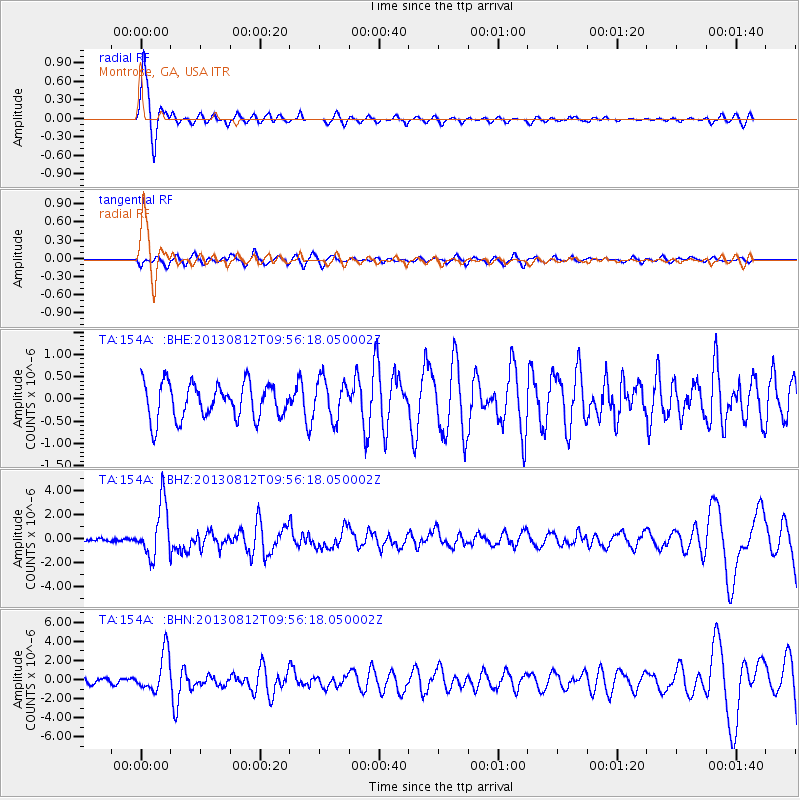
Signal To Noise
| Channel | StoN | STA | LTA |
| TA:154A: :BHZ:20130812T09:56:18.050002Z | 12.85641 | 2.211961E-6 | 1.720512E-7 |
| TA:154A: :BHN:20130812T09:56:18.050002Z | 4.312887 | 2.035022E-6 | 4.7184673E-7 |
| TA:154A: :BHE:20130812T09:56:18.050002Z | 1.1139355 | 4.394277E-7 | 3.944822E-7 |
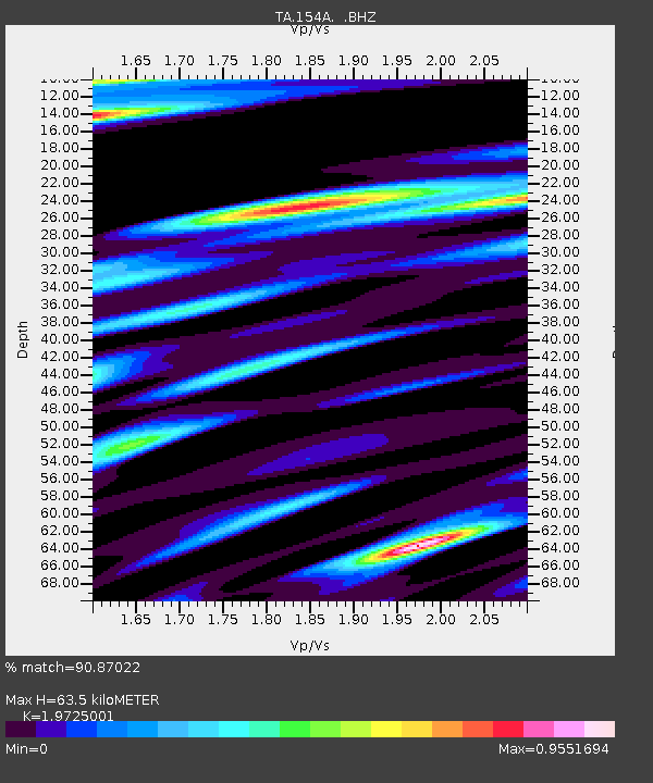
| Arrivals | |
| Ps | 10 SECOND |
| PpPs | 27 SECOND |
| PsPs/PpSs | 37 SECOND |

