155A Kite, GA, USA - Earthquake Result Viewer
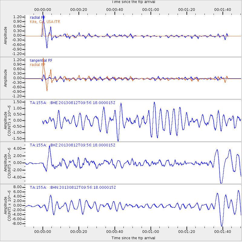
Earthquake location: Near Coast Of Northern Peru
Earthquake latitude/longitude: -5.4/-81.9
Earthquake time(UTC): 2013/08/12 (224) 09:49:32 GMT
Earthquake Depth: 10 km
Earthquake Magnitude: 6.2 MWW, 6.1 MWB, 6.2 MWW, 6.2 MWC, 6.3 MWC
Earthquake Catalog/Contributor: NEIC PDE/NEIC COMCAT
Network: TA USArray Transportable Network (new EarthScope stations)
Station: 155A Kite, GA, USA
Lat/Lon: 32.62 N/82.47 W
Elevation: 93 m
Distance: 37.8 deg
Az: 359.257 deg
Baz: 179.123 deg
Ray Param: 0.075924814
Estimated Moho Depth: 12.5 km
Estimated Crust Vp/Vs: 1.60
Assumed Crust Vp: 6.565 km/s
Estimated Crust Vs: 4.103 km/s
Estimated Crust Poisson's Ratio: 0.18
Radial Match: 92.79287 %
Radial Bump: 332
Transverse Match: 49.270897 %
Transverse Bump: 400
SOD ConfigId: 626651
Insert Time: 2014-04-17 23:18:06.968 +0000
GWidth: 2.5
Max Bumps: 400
Tol: 0.001

Signal To Noise

ChannelStoNSTALTA
TA:155A: :BHZ:20130812T09:56:18.000015Z11.0749462.054252E-61.8548641E-7
TA:155A: :BHN:20130812T09:56:18.000015Z4.89735752.0692958E-64.2253313E-7
TA:155A: :BHE:20130812T09:56:18.000015Z1.72808965.867279E-73.39524E-7
Arrivals
Ps1.2 SECOND
PpPs4.5 SECOND
PsPs/PpSs5.8 SECOND