
252A Lumpkin, GA, USA - Earthquake Result Viewer
| ||||||||||||||||||
| ||||||||||||||||||
| ||||||||||||||||||
|
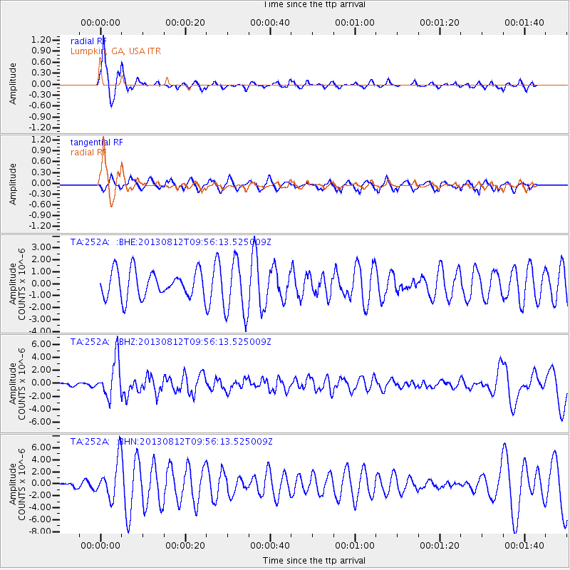
Signal To Noise
| Channel | StoN | STA | LTA |
| TA:252A: :BHZ:20130812T09:56:13.525009Z | 14.625748 | 2.9884427E-6 | 2.0432753E-7 |
| TA:252A: :BHN:20130812T09:56:13.525009Z | 8.00579 | 3.3290594E-6 | 4.1583147E-7 |
| TA:252A: :BHE:20130812T09:56:13.525009Z | 2.1079695 | 2.33776E-6 | 1.1090103E-6 |
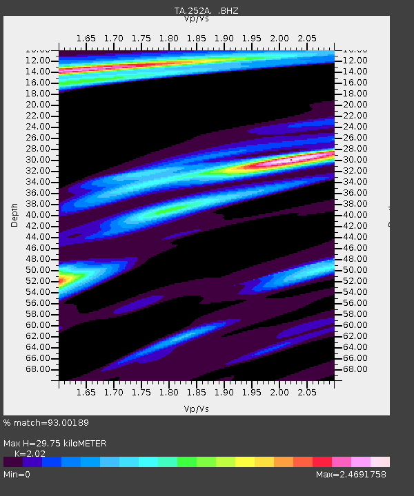
| Arrivals | |
| Ps | 5.1 SECOND |
| PpPs | 13 SECOND |
| PsPs/PpSs | 18 SECOND |

