256A Glennville, GA, USA - Earthquake Result Viewer
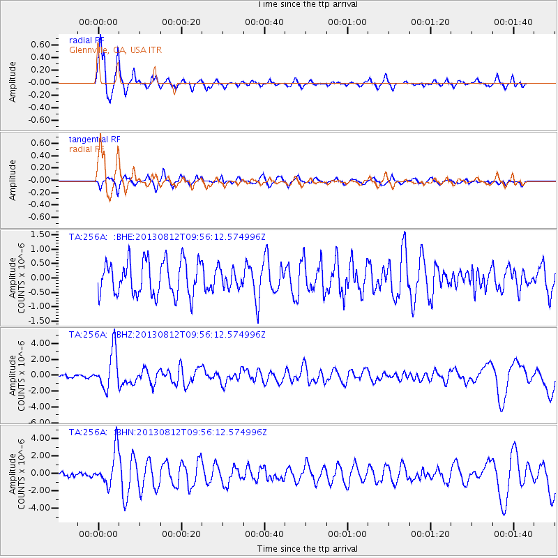
Earthquake location: Near Coast Of Northern Peru
Earthquake latitude/longitude: -5.4/-81.9
Earthquake time(UTC): 2013/08/12 (224) 09:49:32 GMT
Earthquake Depth: 10 km
Earthquake Magnitude: 6.2 MWW, 6.1 MWB, 6.2 MWW, 6.2 MWC, 6.3 MWC
Earthquake Catalog/Contributor: NEIC PDE/NEIC COMCAT
Network: TA USArray Transportable Network (new EarthScope stations)
Station: 256A Glennville, GA, USA
Lat/Lon: 31.98 N/81.89 W
Elevation: 46 m
Distance: 37.2 deg
Az: 0.055 deg
Baz: 180.064 deg
Ray Param: 0.0762832
Estimated Moho Depth: 11.75 km
Estimated Crust Vp/Vs: 1.74
Assumed Crust Vp: 5.989 km/s
Estimated Crust Vs: 3.437 km/s
Estimated Crust Poisson's Ratio: 0.25
Radial Match: 94.08796 %
Radial Bump: 375
Transverse Match: 64.23124 %
Transverse Bump: 400
SOD ConfigId: 626651
Insert Time: 2014-04-17 23:18:51.548 +0000
GWidth: 2.5
Max Bumps: 400
Tol: 0.001

Signal To Noise

ChannelStoNSTALTA
TA:256A: :BHZ:20130812T09:56:12.574996Z15.7791282.4859364E-61.5754587E-7
TA:256A: :BHN:20130812T09:56:12.574996Z6.57465032.0248954E-63.0798523E-7
TA:256A: :BHE:20130812T09:56:12.574996Z0.519253973.0920475E-75.954788E-7
Arrivals
Ps1.6 SECOND
PpPs5.0 SECOND
PsPs/PpSs6.6 SECOND