352A Blakely, GA, USA - Earthquake Result Viewer
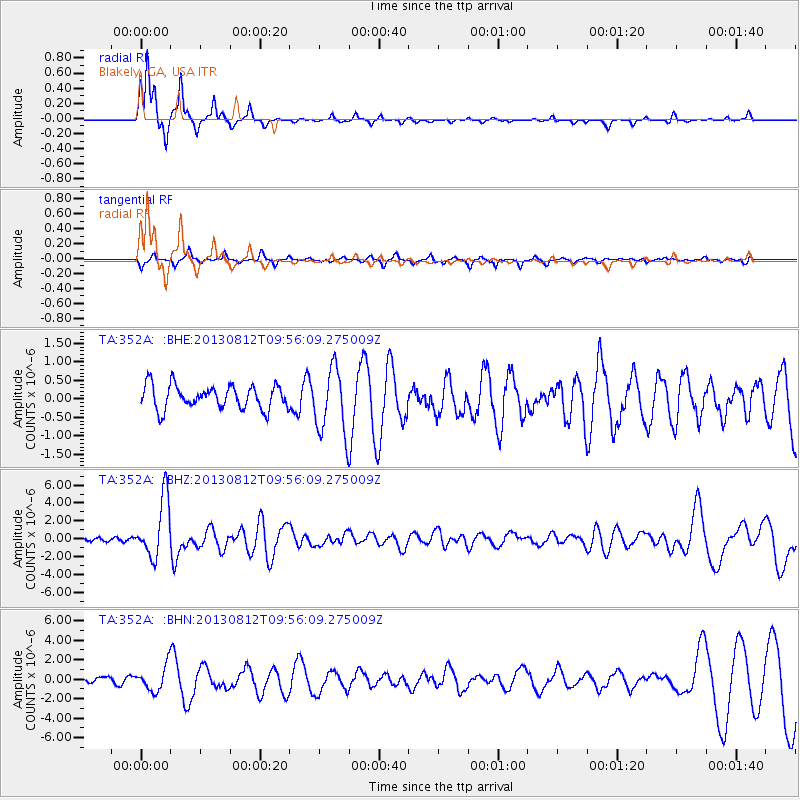
Earthquake location: Near Coast Of Northern Peru
Earthquake latitude/longitude: -5.4/-81.9
Earthquake time(UTC): 2013/08/12 (224) 09:49:32 GMT
Earthquake Depth: 10 km
Earthquake Magnitude: 6.2 MWW, 6.1 MWB, 6.2 MWW, 6.2 MWC, 6.3 MWC
Earthquake Catalog/Contributor: NEIC PDE/NEIC COMCAT
Network: TA USArray Transportable Network (new EarthScope stations)
Station: 352A Blakely, GA, USA
Lat/Lon: 31.48 N/84.93 W
Elevation: 101 m
Distance: 36.8 deg
Az: 355.716 deg
Baz: 175.006 deg
Ray Param: 0.07649422
Estimated Moho Depth: 16.0 km
Estimated Crust Vp/Vs: 1.93
Assumed Crust Vp: 6.347 km/s
Estimated Crust Vs: 3.28 km/s
Estimated Crust Poisson's Ratio: 0.32
Radial Match: 88.11748 %
Radial Bump: 211
Transverse Match: 53.062977 %
Transverse Bump: 295
SOD ConfigId: 626651
Insert Time: 2014-04-17 23:19:02.677 +0000
GWidth: 2.5
Max Bumps: 400
Tol: 0.001

Signal To Noise

ChannelStoNSTALTA
TA:352A: :BHZ:20130812T09:56:09.275009Z10.5882013.3238496E-63.1392014E-7
TA:352A: :BHN:20130812T09:56:09.275009Z3.20234271.2733257E-63.9762318E-7
TA:352A: :BHE:20130812T09:56:09.275009Z2.84582288.992127E-73.1597637E-7
Arrivals
Ps2.5 SECOND
PpPs6.9 SECOND
PsPs/PpSs9.4 SECOND