
356A Blackshear, GA, USA - Earthquake Result Viewer
| ||||||||||||||||||
| ||||||||||||||||||
| ||||||||||||||||||
|
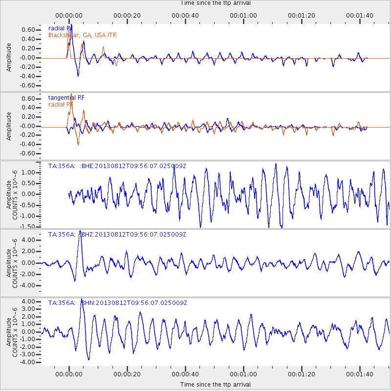
Signal To Noise
| Channel | StoN | STA | LTA |
| TA:356A: :BHZ:20130812T09:56:07.025009Z | 15.122537 | 2.599613E-6 | 1.7190324E-7 |
| TA:356A: :BHN:20130812T09:56:07.025009Z | 6.2031627 | 1.8408347E-6 | 2.9675746E-7 |
| TA:356A: :BHE:20130812T09:56:07.025009Z | 1.8410261 | 5.4438914E-7 | 2.9569875E-7 |
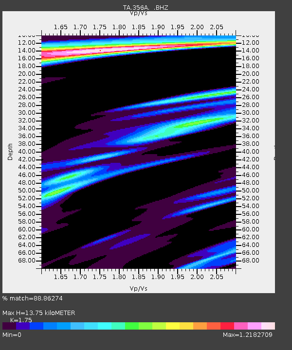
| Arrivals | |
| Ps | 1.7 SECOND |
| PpPs | 5.3 SECOND |
| PsPs/PpSs | 7.0 SECOND |

