555A McAlpin, FL, USA - Earthquake Result Viewer
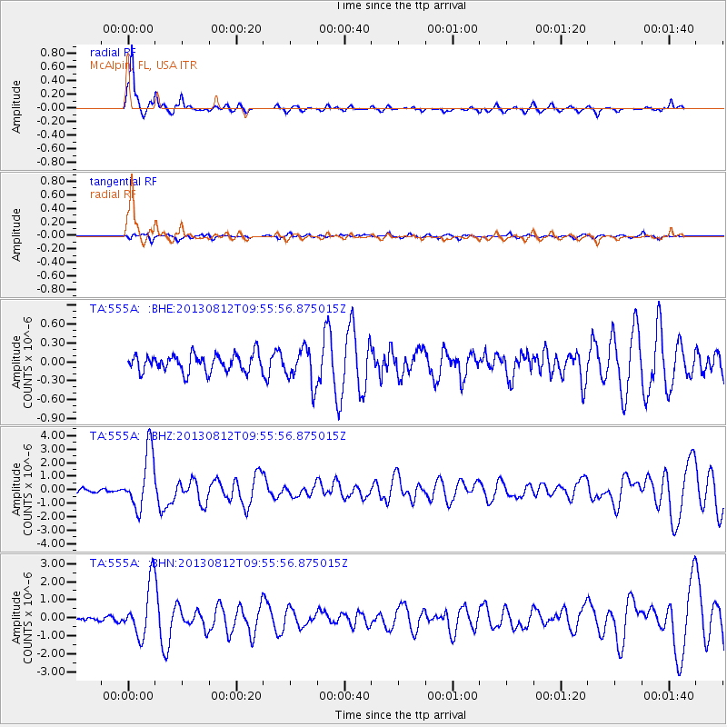
Earthquake location: Near Coast Of Northern Peru
Earthquake latitude/longitude: -5.4/-81.9
Earthquake time(UTC): 2013/08/12 (224) 09:49:32 GMT
Earthquake Depth: 10 km
Earthquake Magnitude: 6.2 MWW, 6.1 MWB, 6.2 MWW, 6.2 MWC, 6.3 MWC
Earthquake Catalog/Contributor: NEIC PDE/NEIC COMCAT
Network: TA USArray Transportable Network (new EarthScope stations)
Station: 555A McAlpin, FL, USA
Lat/Lon: 30.12 N/82.97 W
Elevation: 29 m
Distance: 35.3 deg
Az: 358.442 deg
Baz: 178.21 deg
Ray Param: 0.07728111
Estimated Moho Depth: 18.0 km
Estimated Crust Vp/Vs: 1.61
Assumed Crust Vp: 6.565 km/s
Estimated Crust Vs: 4.09 km/s
Estimated Crust Poisson's Ratio: 0.18
Radial Match: 90.8926 %
Radial Bump: 315
Transverse Match: 52.832584 %
Transverse Bump: 400
SOD ConfigId: 626651
Insert Time: 2014-04-17 23:20:18.349 +0000
GWidth: 2.5
Max Bumps: 400
Tol: 0.001

Signal To Noise

ChannelStoNSTALTA
TA:555A: :BHZ:20130812T09:55:56.875015Z13.7262172.142137E-61.5606172E-7
TA:555A: :BHN:20130812T09:55:56.875015Z15.015041.4902392E-69.924977E-8
TA:555A: :BHE:20130812T09:55:56.875015Z2.14866832.9263379E-71.361931E-7
Arrivals
Ps1.8 SECOND
PpPs6.5 SECOND
PsPs/PpSs8.4 SECOND