655A Horseshoe Beach, FL, USA - Earthquake Result Viewer
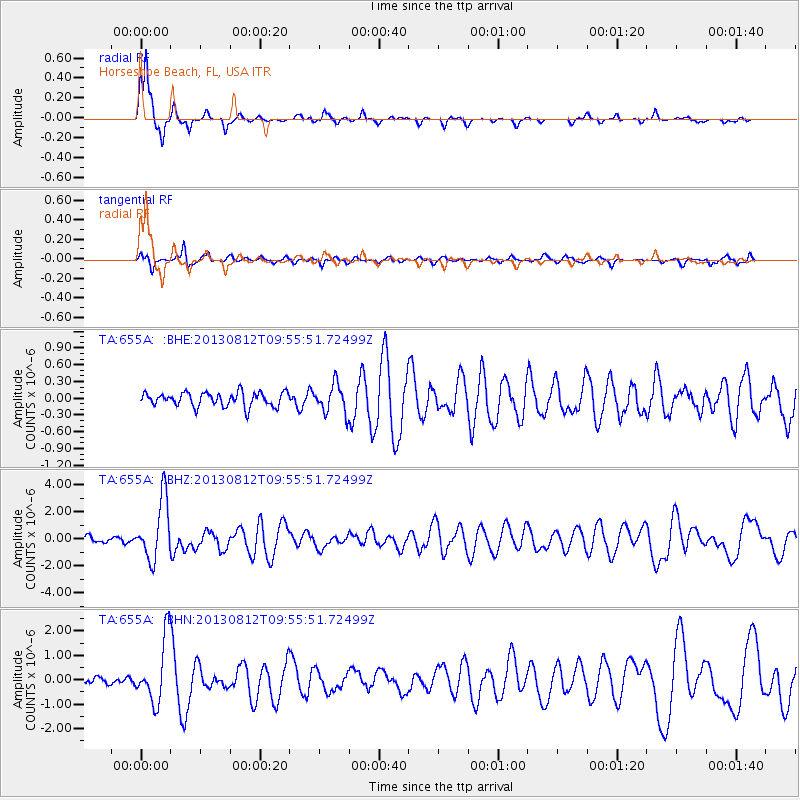
Earthquake location: Near Coast Of Northern Peru
Earthquake latitude/longitude: -5.4/-81.9
Earthquake time(UTC): 2013/08/12 (224) 09:49:32 GMT
Earthquake Depth: 10 km
Earthquake Magnitude: 6.2 MWW, 6.1 MWB, 6.2 MWW, 6.2 MWC, 6.3 MWC
Earthquake Catalog/Contributor: NEIC PDE/NEIC COMCAT
Network: TA USArray Transportable Network (new EarthScope stations)
Station: 655A Horseshoe Beach, FL, USA
Lat/Lon: 29.51 N/83.26 W
Elevation: 6.0 m
Distance: 34.7 deg
Az: 357.967 deg
Baz: 177.678 deg
Ray Param: 0.07759083
Estimated Moho Depth: 16.25 km
Estimated Crust Vp/Vs: 1.61
Assumed Crust Vp: 5.989 km/s
Estimated Crust Vs: 3.726 km/s
Estimated Crust Poisson's Ratio: 0.18
Radial Match: 93.335106 %
Radial Bump: 227
Transverse Match: 74.660355 %
Transverse Bump: 328
SOD ConfigId: 626651
Insert Time: 2014-04-17 23:20:25.879 +0000
GWidth: 2.5
Max Bumps: 400
Tol: 0.001

Signal To Noise

ChannelStoNSTALTA
TA:655A: :BHZ:20130812T09:55:51.72499Z10.9038392.224998E-62.040564E-7
TA:655A: :BHN:20130812T09:55:51.72499Z8.3701131.3117613E-61.5671965E-7
TA:655A: :BHE:20130812T09:55:51.72499Z2.06791422.5793847E-71.2473363E-7
Arrivals
Ps1.8 SECOND
PpPs6.6 SECOND
PsPs/PpSs8.4 SECOND