
656A Willston, FL, USA - Earthquake Result Viewer
| ||||||||||||||||||
| ||||||||||||||||||
| ||||||||||||||||||
|
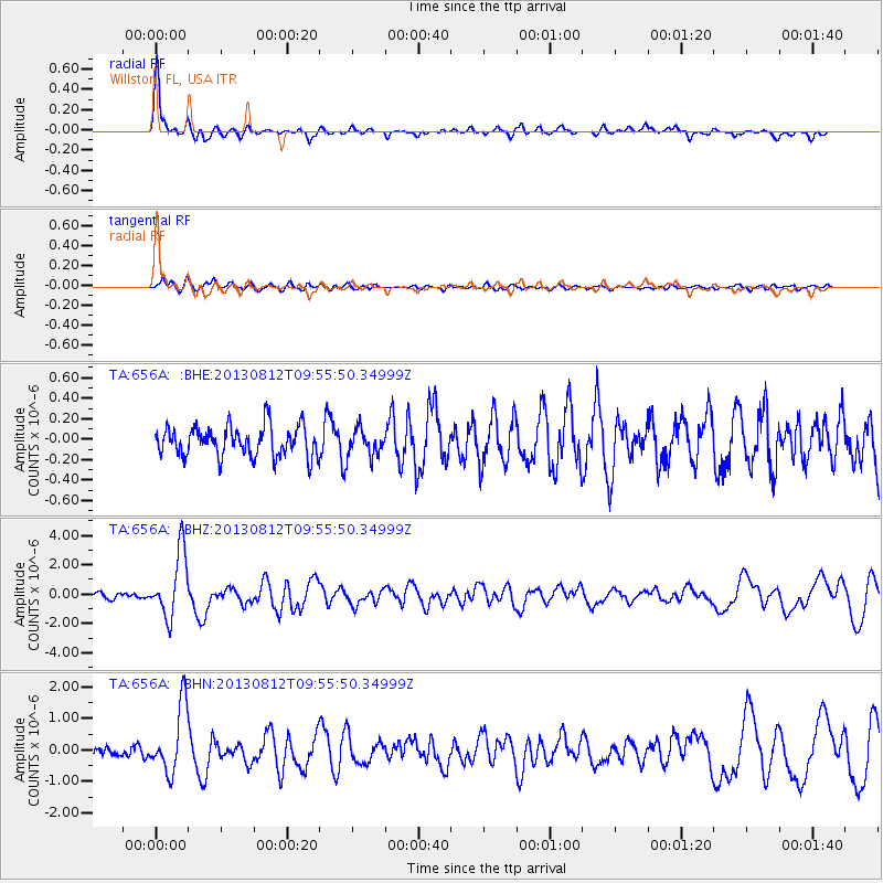
Signal To Noise
| Channel | StoN | STA | LTA |
| TA:656A: :BHZ:20130812T09:55:50.34999Z | 13.458671 | 2.2235884E-6 | 1.6521604E-7 |
| TA:656A: :BHN:20130812T09:55:50.34999Z | 7.9592032 | 1.0671342E-6 | 1.340755E-7 |
| TA:656A: :BHE:20130812T09:55:50.34999Z | 0.91093564 | 1.3358661E-7 | 1.466477E-7 |
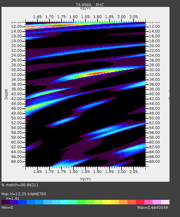
| Arrivals | |
| Ps | 1.3 SECOND |
| PpPs | 5.0 SECOND |
| PsPs/PpSs | 6.3 SECOND |

