657A Interlachen, FL, USA - Earthquake Result Viewer
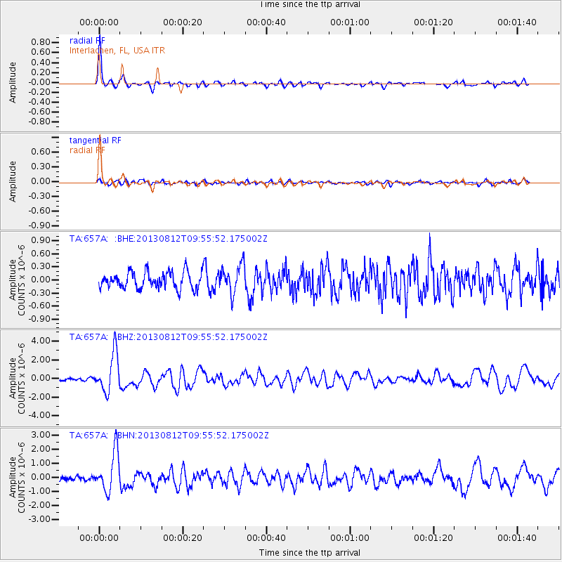
Earthquake location: Near Coast Of Northern Peru
Earthquake latitude/longitude: -5.4/-81.9
Earthquake time(UTC): 2013/08/12 (224) 09:49:32 GMT
Earthquake Depth: 10 km
Earthquake Magnitude: 6.2 MWW, 6.1 MWB, 6.2 MWW, 6.2 MWC, 6.3 MWC
Earthquake Catalog/Contributor: NEIC PDE/NEIC COMCAT
Network: TA USArray Transportable Network (new EarthScope stations)
Station: 657A Interlachen, FL, USA
Lat/Lon: 29.59 N/81.87 W
Elevation: 34 m
Distance: 34.8 deg
Az: 0.092 deg
Baz: 180.105 deg
Ray Param: 0.07756455
Estimated Moho Depth: 42.75 km
Estimated Crust Vp/Vs: 1.78
Assumed Crust Vp: 6.134 km/s
Estimated Crust Vs: 3.446 km/s
Estimated Crust Poisson's Ratio: 0.27
Radial Match: 91.04597 %
Radial Bump: 355
Transverse Match: 57.407116 %
Transverse Bump: 400
SOD ConfigId: 626651
Insert Time: 2014-04-17 23:20:36.272 +0000
GWidth: 2.5
Max Bumps: 400
Tol: 0.001

Signal To Noise

ChannelStoNSTALTA
TA:657A: :BHZ:20130812T09:55:52.175002Z17.3583552.136516E-61.2308287E-7
TA:657A: :BHN:20130812T09:55:52.175002Z9.4072451.4537665E-61.545369E-7
TA:657A: :BHE:20130812T09:55:52.175002Z1.74974853.318871E-71.8967702E-7
Arrivals
Ps5.8 SECOND
PpPs18 SECOND
PsPs/PpSs24 SECOND