757A Oxford, FL, USA - Earthquake Result Viewer
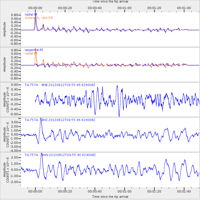
Earthquake location: Near Coast Of Northern Peru
Earthquake latitude/longitude: -5.4/-81.9
Earthquake time(UTC): 2013/08/12 (224) 09:49:32 GMT
Earthquake Depth: 10 km
Earthquake Magnitude: 6.2 MWW, 6.1 MWB, 6.2 MWW, 6.2 MWC, 6.3 MWC
Earthquake Catalog/Contributor: NEIC PDE/NEIC COMCAT
Network: TA USArray Transportable Network (new EarthScope stations)
Station: 757A Oxford, FL, USA
Lat/Lon: 28.94 N/82.07 W
Elevation: 22 m
Distance: 34.1 deg
Az: 359.779 deg
Baz: 179.749 deg
Ray Param: 0.07788469
Estimated Moho Depth: 34.5 km
Estimated Crust Vp/Vs: 1.88
Assumed Crust Vp: 5.989 km/s
Estimated Crust Vs: 3.181 km/s
Estimated Crust Poisson's Ratio: 0.30
Radial Match: 92.249146 %
Radial Bump: 369
Transverse Match: 66.48878 %
Transverse Bump: 400
SOD ConfigId: 626651
Insert Time: 2014-04-17 23:20:44.624 +0000
GWidth: 2.5
Max Bumps: 400
Tol: 0.001

Signal To Noise

ChannelStoNSTALTA
TA:757A: :BHZ:20130812T09:55:46.624008Z14.3158311.8347697E-61.2816369E-7
TA:757A: :BHN:20130812T09:55:46.624008Z7.64104181.2528664E-61.639654E-7
TA:757A: :BHE:20130812T09:55:46.624008Z1.13952481.4574212E-71.2789728E-7
Arrivals
Ps5.4 SECOND
PpPs16 SECOND
PsPs/PpSs21 SECOND