A04D Lummi Island, WA, USA - Earthquake Result Viewer
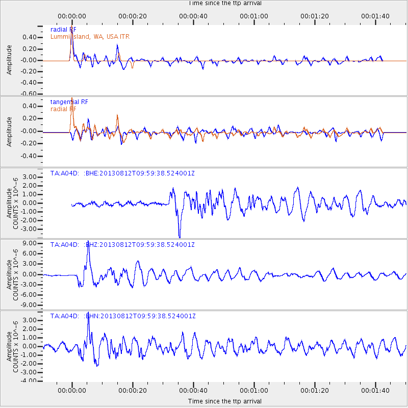
Earthquake location: Near Coast Of Northern Peru
Earthquake latitude/longitude: -5.4/-81.9
Earthquake time(UTC): 2013/08/12 (224) 09:49:32 GMT
Earthquake Depth: 10 km
Earthquake Magnitude: 6.2 MWW, 6.1 MWB, 6.2 MWW, 6.2 MWC, 6.3 MWC
Earthquake Catalog/Contributor: NEIC PDE/NEIC COMCAT
Network: TA USArray Transportable Network (new EarthScope stations)
Station: A04D Lummi Island, WA, USA
Lat/Lon: 48.72 N/122.71 W
Elevation: 13 m
Distance: 64.6 deg
Az: 331.386 deg
Baz: 133.945 deg
Ray Param: 0.058832042
Estimated Moho Depth: 14.75 km
Estimated Crust Vp/Vs: 1.60
Assumed Crust Vp: 6.566 km/s
Estimated Crust Vs: 4.104 km/s
Estimated Crust Poisson's Ratio: 0.18
Radial Match: 91.0947 %
Radial Bump: 400
Transverse Match: 76.269714 %
Transverse Bump: 400
SOD ConfigId: 626651
Insert Time: 2014-04-17 23:21:15.900 +0000
GWidth: 2.5
Max Bumps: 400
Tol: 0.001

Signal To Noise

ChannelStoNSTALTA
TA:A04D: :BHZ:20130812T09:59:38.524001Z17.2165221.8440131E-61.0710717E-7
TA:A04D: :BHN:20130812T09:59:38.524001Z2.36364726.296683E-72.663969E-7
TA:A04D: :BHE:20130812T09:59:38.524001Z4.96759567.967953E-71.6039859E-7
Arrivals
Ps1.4 SECOND
PpPs5.6 SECOND
PsPs/PpSs7.0 SECOND