You are here: Home > Network List > TA - USArray Transportable Network (new EarthScope stations) Stations List
> Station D46A Sault St. Marie, ON, CAN > Earthquake Result Viewer
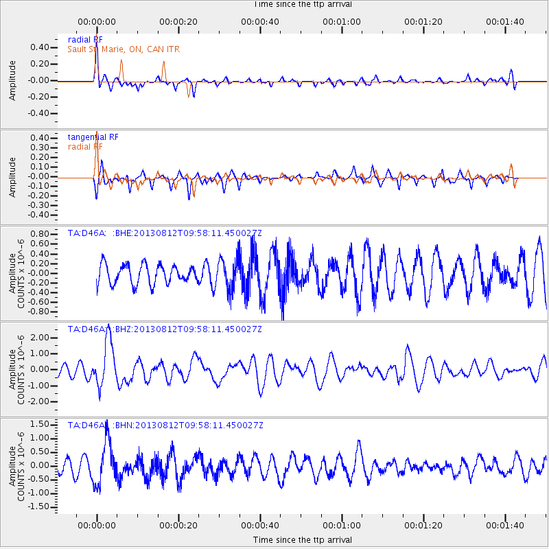
D46A Sault St. Marie, ON, CAN - Earthquake Result Viewer
*The percent match for this event was below the threshold and hence no stack was calculated.
| Earthquake location: |
Near Coast Of Northern Peru |
| Earthquake latitude/longitude: |
-5.4/-81.9 |
| Earthquake time(UTC): |
2013/08/12 (224) 09:49:32 GMT |
| Earthquake Depth: |
10 km |
| Earthquake Magnitude: |
6.2 MWW, 6.1 MWB, 6.2 MWW, 6.2 MWC, 6.3 MWC |
| Earthquake Catalog/Contributor: |
NEIC PDE/NEIC COMCAT |
|
| Network: |
TA USArray Transportable Network (new EarthScope stations) |
| Station: |
D46A Sault St. Marie, ON, CAN |
| Lat/Lon: |
46.89 N/84.04 W |
| Elevation: |
353 m |
|
| Distance: |
52.1 deg |
| Az: |
358.167 deg |
| Baz: |
177.338 deg |
| Ray Param: |
$rayparam |
*The percent match for this event was below the threshold and hence was not used in the summary stack. |
|
| Radial Match: |
47.679756 % |
| Radial Bump: |
400 |
| Transverse Match: |
66.08596 % |
| Transverse Bump: |
357 |
| SOD ConfigId: |
626651 |
| Insert Time: |
2014-04-17 23:21:52.824 +0000 |
| GWidth: |
2.5 |
| Max Bumps: |
400 |
| Tol: |
0.001 |
|
Signal To Noise
| Channel | StoN | STA | LTA |
| TA:D46A: :BHZ:20130812T09:58:11.450027Z | 4.744547 | 1.4598189E-6 | 3.0768354E-7 |
| TA:D46A: :BHN:20130812T09:58:11.450027Z | 3.3560848 | 8.025088E-7 | 2.3912054E-7 |
| TA:D46A: :BHE:20130812T09:58:11.450027Z | 1.6069626 | 3.15079E-7 | 1.9607117E-7 |
| Arrivals |
| Ps | |
| PpPs | |
| PsPs/PpSs | |


