
D41A Chassel, MI, USA - Earthquake Result Viewer
| ||||||||||||||||||
| ||||||||||||||||||
| ||||||||||||||||||
|
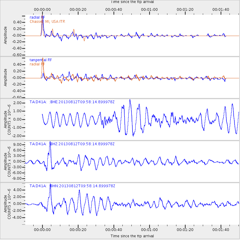
Signal To Noise
| Channel | StoN | STA | LTA |
| TA:D41A: :BHZ:20130812T09:58:14.899978Z | 9.407283 | 4.2377624E-6 | 4.504768E-7 |
| TA:D41A: :BHN:20130812T09:58:14.899978Z | 5.368519 | 2.1460892E-6 | 3.9975444E-7 |
| TA:D41A: :BHE:20130812T09:58:14.899978Z | 0.8851508 | 4.9841265E-7 | 5.630822E-7 |
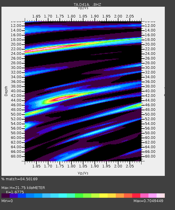
| Arrivals | |
| Ps | 2.4 SECOND |
| PpPs | 8.5 SECOND |
| PsPs/PpSs | 11 SECOND |

