H46A Fife Lake, MI, USA - Earthquake Result Viewer
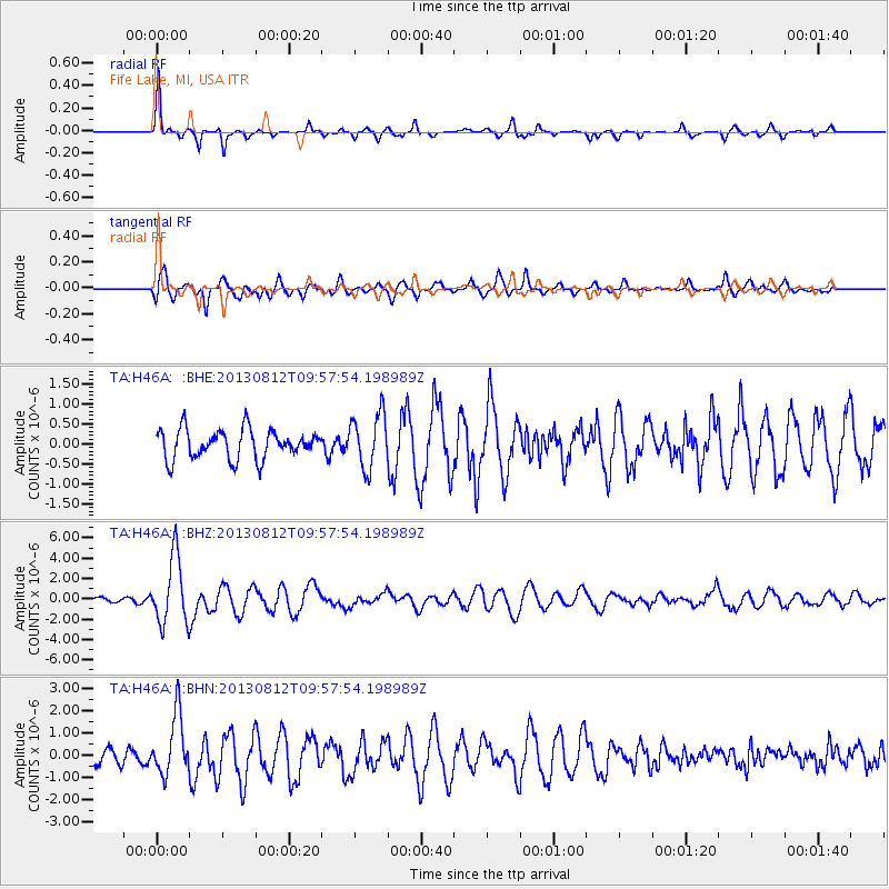
Earthquake location: Near Coast Of Northern Peru
Earthquake latitude/longitude: -5.4/-81.9
Earthquake time(UTC): 2013/08/12 (224) 09:49:32 GMT
Earthquake Depth: 10 km
Earthquake Magnitude: 6.2 MWW, 6.1 MWB, 6.2 MWW, 6.2 MWC, 6.3 MWC
Earthquake Catalog/Contributor: NEIC PDE/NEIC COMCAT
Network: TA USArray Transportable Network (new EarthScope stations)
Station: H46A Fife Lake, MI, USA
Lat/Lon: 44.54 N/85.20 W
Elevation: 329 m
Distance: 49.8 deg
Az: 356.932 deg
Baz: 175.727 deg
Ray Param: 0.06847345
Estimated Moho Depth: 10.5 km
Estimated Crust Vp/Vs: 2.08
Assumed Crust Vp: 6.483 km/s
Estimated Crust Vs: 3.113 km/s
Estimated Crust Poisson's Ratio: 0.35
Radial Match: 84.489426 %
Radial Bump: 243
Transverse Match: 76.38008 %
Transverse Bump: 400
SOD ConfigId: 626651
Insert Time: 2014-04-17 23:26:01.877 +0000
GWidth: 2.5
Max Bumps: 400
Tol: 0.001

Signal To Noise

ChannelStoNSTALTA
TA:H46A: :BHZ:20130812T09:57:54.198989Z7.17258643.2722996E-64.562231E-7
TA:H46A: :BHN:20130812T09:57:54.198989Z2.2898751.3558825E-65.921208E-7
TA:H46A: :BHE:20130812T09:57:54.198989Z1.85812356.766516E-73.6415858E-7
Arrivals
Ps1.8 SECOND
PpPs4.7 SECOND
PsPs/PpSs6.6 SECOND