
I05D Terrebonne, OR, USA - Earthquake Result Viewer
| ||||||||||||||||||
| ||||||||||||||||||
| ||||||||||||||||||
|
Signal To Noise
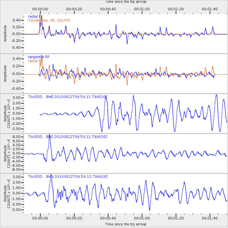
| Channel | StoN | STA | LTA |
| TA:I05D: :BHZ:20130812T09:59:13.799026Z | 11.948781 | 1.7866291E-6 | 1.4952397E-7 |
| TA:I05D: :BHN:20130812T09:59:13.799026Z | 5.2660456 | 6.8355286E-7 | 1.2980382E-7 |
| TA:I05D: :BHE:20130812T09:59:13.799026Z | 4.227361 | 6.4734223E-7 | 1.5313152E-7 |
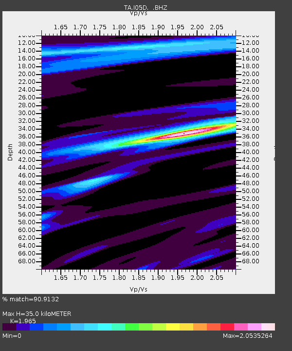
| Arrivals | |
| Ps | 5.3 SECOND |
| PpPs | 15 SECOND |
| PsPs/PpSs | 20 SECOND |

