
I45A Fountain, MI, USA - Earthquake Result Viewer
| ||||||||||||||||||
| ||||||||||||||||||
| ||||||||||||||||||
|
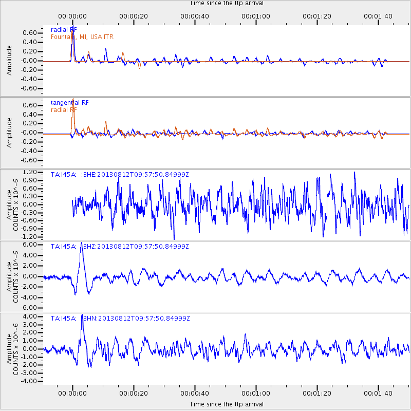
Signal To Noise
| Channel | StoN | STA | LTA |
| TA:I45A: :BHZ:20130812T09:57:50.84999Z | 13.1303835 | 2.8766642E-6 | 2.1908455E-7 |
| TA:I45A: :BHN:20130812T09:57:50.84999Z | 5.304419 | 1.6635503E-6 | 3.136159E-7 |
| TA:I45A: :BHE:20130812T09:57:50.84999Z | 1.4801004 | 4.8792816E-7 | 3.2965883E-7 |
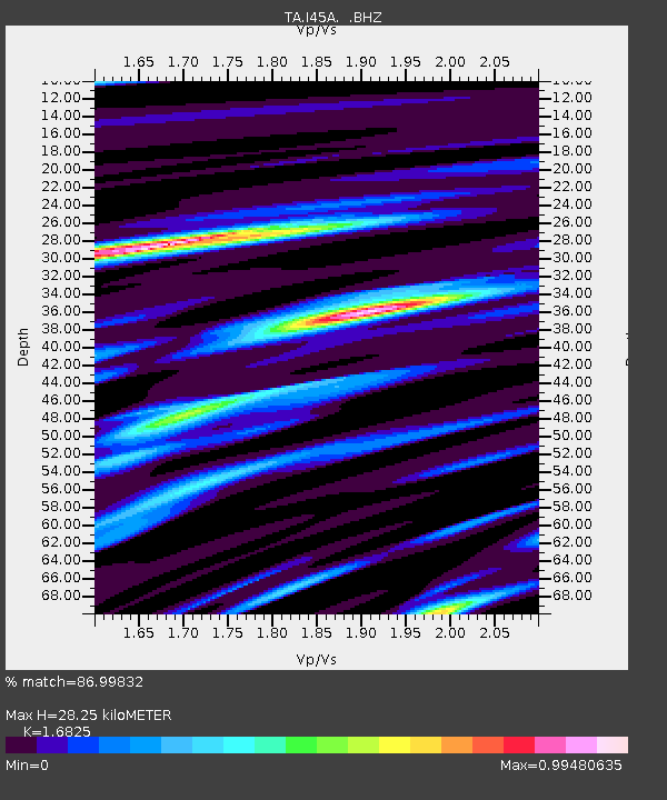
| Arrivals | |
| Ps | 3.1 SECOND |
| PpPs | 11 SECOND |
| PsPs/PpSs | 14 SECOND |

