I46A Reed City, MI, USA - Earthquake Result Viewer
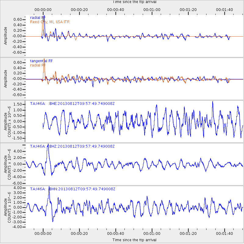
Earthquake location: Near Coast Of Northern Peru
Earthquake latitude/longitude: -5.4/-81.9
Earthquake time(UTC): 2013/08/12 (224) 09:49:32 GMT
Earthquake Depth: 10 km
Earthquake Magnitude: 6.2 MWW, 6.1 MWB, 6.2 MWW, 6.2 MWC, 6.3 MWC
Earthquake Catalog/Contributor: NEIC PDE/NEIC COMCAT
Network: TA USArray Transportable Network (new EarthScope stations)
Station: I46A Reed City, MI, USA
Lat/Lon: 43.94 N/85.45 W
Elevation: 359 m
Distance: 49.2 deg
Az: 356.641 deg
Baz: 175.369 deg
Ray Param: 0.0688446
Estimated Moho Depth: 47.75 km
Estimated Crust Vp/Vs: 1.90
Assumed Crust Vp: 6.483 km/s
Estimated Crust Vs: 3.416 km/s
Estimated Crust Poisson's Ratio: 0.31
Radial Match: 80.26921 %
Radial Bump: 400
Transverse Match: 62.355045 %
Transverse Bump: 400
SOD ConfigId: 626651
Insert Time: 2014-04-17 23:26:43.567 +0000
GWidth: 2.5
Max Bumps: 400
Tol: 0.001

Signal To Noise

ChannelStoNSTALTA
TA:I46A: :BHZ:20130812T09:57:49.749008Z6.79986332.9271152E-64.304668E-7
TA:I46A: :BHN:20130812T09:57:49.749008Z3.27598951.4920755E-64.5545795E-7
TA:I46A: :BHE:20130812T09:57:49.749008Z0.79635874.226051E-75.306718E-7
Arrivals
Ps7.0 SECOND
PpPs20 SECOND
PsPs/PpSs27 SECOND