J45A Montague, MI, USA - Earthquake Result Viewer
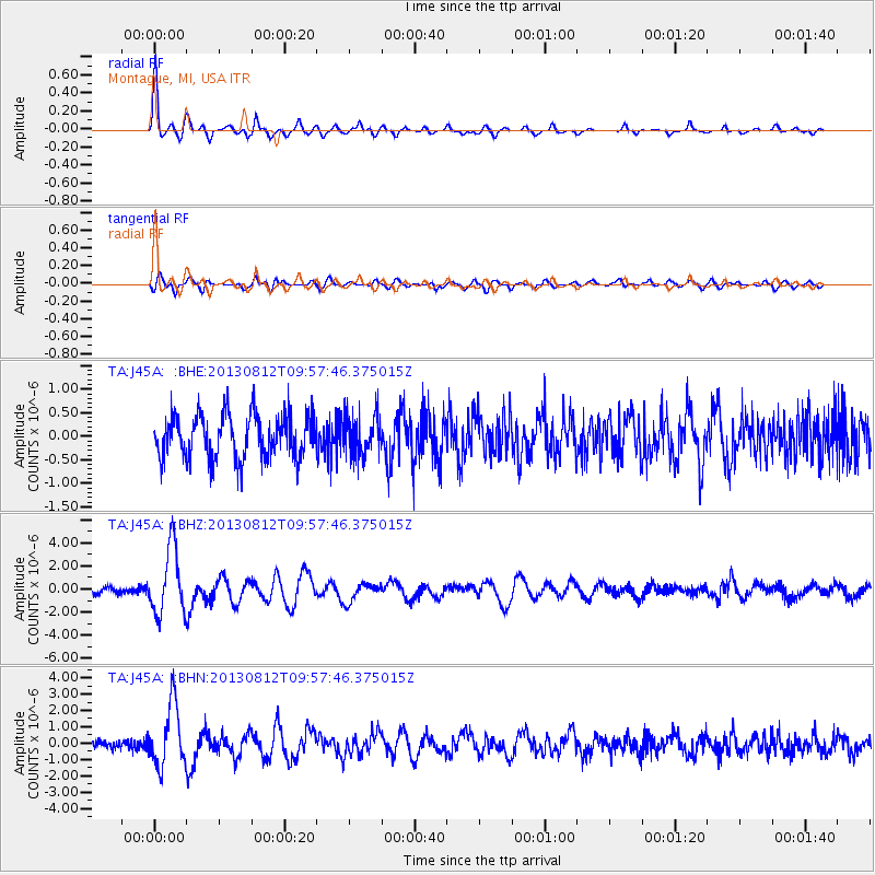
Earthquake location: Near Coast Of Northern Peru
Earthquake latitude/longitude: -5.4/-81.9
Earthquake time(UTC): 2013/08/12 (224) 09:49:32 GMT
Earthquake Depth: 10 km
Earthquake Magnitude: 6.2 MWW, 6.1 MWB, 6.2 MWW, 6.2 MWC, 6.3 MWC
Earthquake Catalog/Contributor: NEIC PDE/NEIC COMCAT
Network: TA USArray Transportable Network (new EarthScope stations)
Station: J45A Montague, MI, USA
Lat/Lon: 43.44 N/86.39 W
Elevation: 209 m
Distance: 48.8 deg
Az: 355.678 deg
Baz: 174.088 deg
Ray Param: 0.06913938
Estimated Moho Depth: 38.75 km
Estimated Crust Vp/Vs: 1.77
Assumed Crust Vp: 6.483 km/s
Estimated Crust Vs: 3.652 km/s
Estimated Crust Poisson's Ratio: 0.27
Radial Match: 90.5468 %
Radial Bump: 400
Transverse Match: 66.40791 %
Transverse Bump: 400
SOD ConfigId: 626651
Insert Time: 2014-04-17 23:27:21.500 +0000
GWidth: 2.5
Max Bumps: 400
Tol: 0.001

Signal To Noise

ChannelStoNSTALTA
TA:J45A: :BHZ:20130812T09:57:46.375015Z5.6535632.896393E-65.123128E-7
TA:J45A: :BHN:20130812T09:57:46.375015Z5.52878141.9053734E-63.446281E-7
TA:J45A: :BHE:20130812T09:57:46.375015Z0.92605764.342324E-74.689043E-7
Arrivals
Ps4.9 SECOND
PpPs16 SECOND
PsPs/PpSs21 SECOND