You are here: Home > Network List > G - GEOSCOPE Stations List
> Station PPTF Pamatai - Papeete - Tahiti island - French Polynesia, France > Earthquake Result Viewer
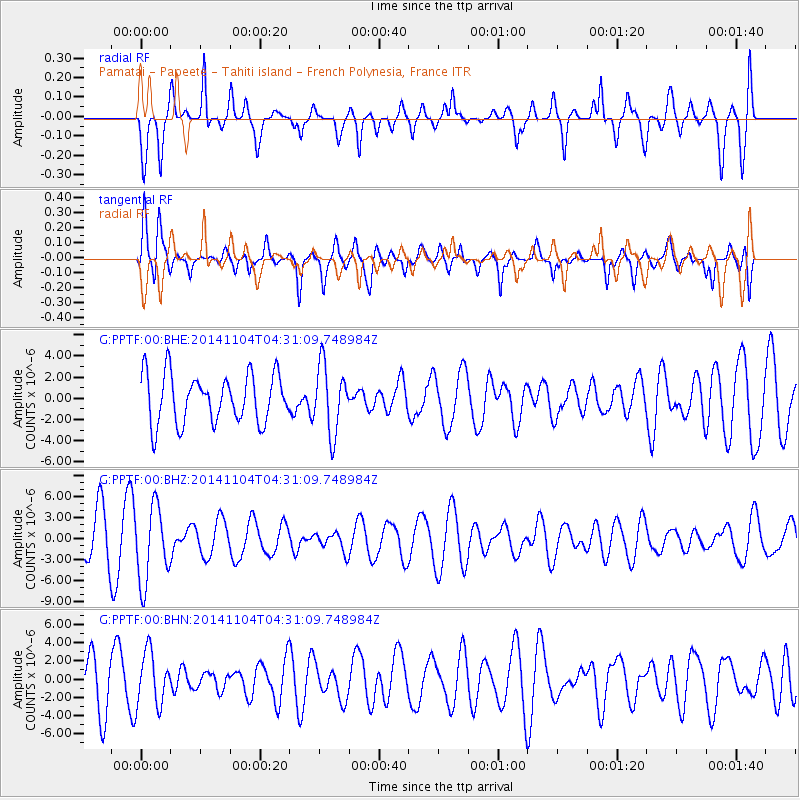
PPTF Pamatai - Papeete - Tahiti island - French Polynesia, France - Earthquake Result Viewer
*The percent match for this event was below the threshold and hence no stack was calculated.
| Earthquake location: |
Minahassa Peninsula, Sulawesi |
| Earthquake latitude/longitude: |
0.0/123.7 |
| Earthquake time(UTC): |
2014/11/04 (308) 04:19:11 GMT |
| Earthquake Depth: |
138 km |
| Earthquake Magnitude: |
4.9 MW, 5.0 mb |
| Earthquake Catalog/Contributor: |
ISC/ISC |
|
| Network: |
G GEOSCOPE |
| Station: |
PPTF Pamatai - Papeete - Tahiti island - French Polynesia, France |
| Lat/Lon: |
17.59 S/149.57 W |
| Elevation: |
705 m |
|
| Distance: |
86.9 deg |
| Az: |
107.507 deg |
| Baz: |
271.006 deg |
| Ray Param: |
$rayparam |
*The percent match for this event was below the threshold and hence was not used in the summary stack. |
|
| Radial Match: |
53.016983 % |
| Radial Bump: |
367 |
| Transverse Match: |
45.366844 % |
| Transverse Bump: |
400 |
| SOD ConfigId: |
3390531 |
| Insert Time: |
2019-04-14 20:45:11.745 +0000 |
| GWidth: |
2.5 |
| Max Bumps: |
400 |
| Tol: |
0.001 |
|
Signal To Noise
| Channel | StoN | STA | LTA |
| G:PPTF:00:BHZ:20141104T04:31:09.748984Z | 2.1417542 | 5.50098E-6 | 2.5684462E-6 |
| G:PPTF:00:BHN:20141104T04:31:09.748984Z | 1.3474689 | 2.8923923E-6 | 2.1465376E-6 |
| G:PPTF:00:BHE:20141104T04:31:09.748984Z | 1.3888391 | 3.1805105E-6 | 2.2900495E-6 |
| Arrivals |
| Ps | |
| PpPs | |
| PsPs/PpSs | |


