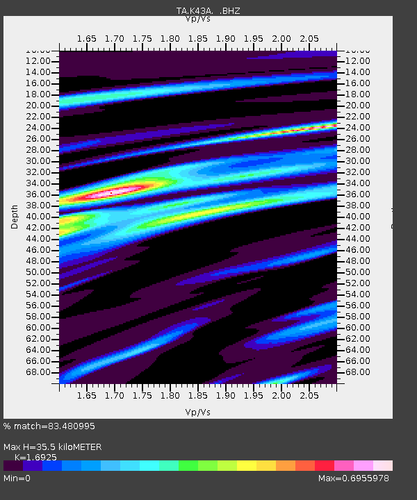
K43A Burlington, WI, USA - Earthquake Result Viewer
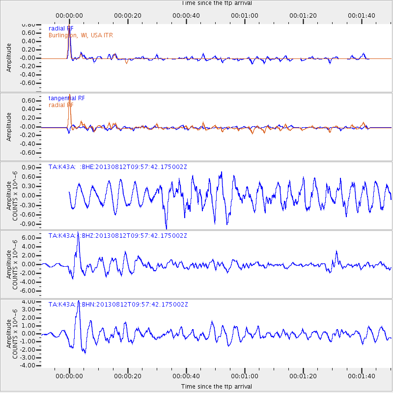
Earthquake location: Near Coast Of Northern Peru
Earthquake latitude/longitude: -5.4/-81.9
Earthquake time(UTC): 2013/08/12 (224) 09:49:32 GMT
Earthquake Depth: 10 km
Earthquake Magnitude: 6.2 MWW, 6.1 MWB, 6.2 MWW, 6.2 MWC, 6.3 MWC
Earthquake Catalog/Contributor: NEIC PDE/NEIC COMCAT
Network: TA USArray Transportable Network (new EarthScope stations)
Station: K43A Burlington, WI, USA
Lat/Lon: 42.70 N/88.33 W
Elevation: 264 m
Distance: 48.2 deg
Az: 353.669 deg
Baz: 171.435 deg
Ray Param: 0.069495626
Estimated Moho Depth: 35.5 km
Estimated Crust Vp/Vs: 1.69
Assumed Crust Vp: 6.571 km/s
Estimated Crust Vs: 3.882 km/s
Estimated Crust Poisson's Ratio: 0.23
Radial Match: 83.480995 %
Radial Bump: 350
Transverse Match: 64.66639 %
Transverse Bump: 400
SOD ConfigId: 626651
Insert Time: 2014-04-17 23:27:55.587 +0000
GWidth: 2.5
Max Bumps: 400
Tol: 0.001

Signal To Noise

ChannelStoNSTALTA
TA:K43A: :BHZ:20130812T09:57:42.175002Z9.43709852.8404684E-63.009896E-7
TA:K43A: :BHN:20130812T09:57:42.175002Z8.6397932.0101663E-62.3266371E-7
TA:K43A: :BHE:20130812T09:57:42.175002Z1.36009823.851487E-72.8317712E-7
Arrivals
Ps4.0 SECOND
PpPs14 SECOND
PsPs/PpSs18 SECOND