K49A Clarkson, MI, USA - Earthquake Result Viewer
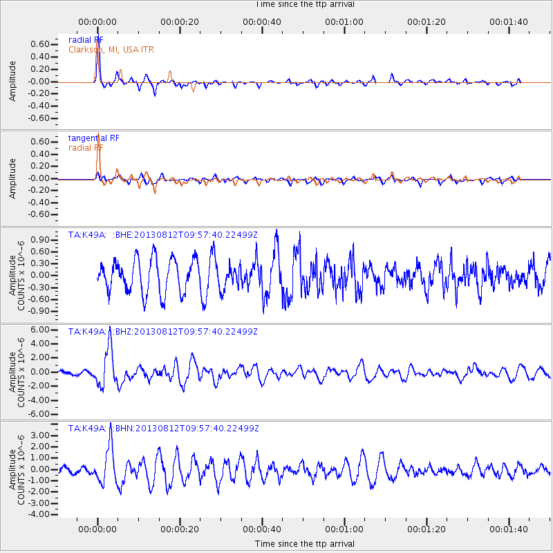
Earthquake location: Near Coast Of Northern Peru
Earthquake latitude/longitude: -5.4/-81.9
Earthquake time(UTC): 2013/08/12 (224) 09:49:32 GMT
Earthquake Depth: 10 km
Earthquake Magnitude: 6.2 MWW, 6.1 MWB, 6.2 MWW, 6.2 MWC, 6.3 MWC
Earthquake Catalog/Contributor: NEIC PDE/NEIC COMCAT
Network: TA USArray Transportable Network (new EarthScope stations)
Station: K49A Clarkson, MI, USA
Lat/Lon: 42.78 N/83.46 W
Elevation: 336 m
Distance: 48.0 deg
Az: 358.485 deg
Baz: 177.951 deg
Ray Param: 0.06965347
Estimated Moho Depth: 40.0 km
Estimated Crust Vp/Vs: 1.73
Assumed Crust Vp: 6.483 km/s
Estimated Crust Vs: 3.753 km/s
Estimated Crust Poisson's Ratio: 0.25
Radial Match: 86.542465 %
Radial Bump: 331
Transverse Match: 70.38412 %
Transverse Bump: 400
SOD ConfigId: 626651
Insert Time: 2014-04-17 23:28:05.619 +0000
GWidth: 2.5
Max Bumps: 400
Tol: 0.001

Signal To Noise

ChannelStoNSTALTA
TA:K49A: :BHZ:20130812T09:57:40.22499Z8.37474252.7485996E-63.282011E-7
TA:K49A: :BHN:20130812T09:57:40.22499Z7.27433631.6588297E-62.2803862E-7
TA:K49A: :BHE:20130812T09:57:40.22499Z0.678681142.8014745E-74.1278216E-7
Arrivals
Ps4.8 SECOND
PpPs16 SECOND
PsPs/PpSs21 SECOND