L40A Anamosa, IA, USA - Earthquake Result Viewer
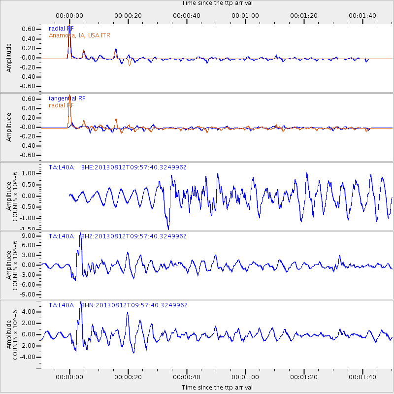
Earthquake location: Near Coast Of Northern Peru
Earthquake latitude/longitude: -5.4/-81.9
Earthquake time(UTC): 2013/08/12 (224) 09:49:32 GMT
Earthquake Depth: 10 km
Earthquake Magnitude: 6.2 MWW, 6.1 MWB, 6.2 MWW, 6.2 MWC, 6.3 MWC
Earthquake Catalog/Contributor: NEIC PDE/NEIC COMCAT
Network: TA USArray Transportable Network (new EarthScope stations)
Station: L40A Anamosa, IA, USA
Lat/Lon: 42.06 N/91.22 W
Elevation: 242 m
Distance: 48.0 deg
Az: 350.684 deg
Baz: 167.5 deg
Ray Param: 0.06964426
Estimated Moho Depth: 46.75 km
Estimated Crust Vp/Vs: 2.01
Assumed Crust Vp: 6.53 km/s
Estimated Crust Vs: 3.253 km/s
Estimated Crust Poisson's Ratio: 0.33
Radial Match: 85.08333 %
Radial Bump: 265
Transverse Match: 69.16566 %
Transverse Bump: 400
SOD ConfigId: 626651
Insert Time: 2014-04-17 23:28:37.867 +0000
GWidth: 2.5
Max Bumps: 400
Tol: 0.001

Signal To Noise

ChannelStoNSTALTA
TA:L40A: :BHZ:20130812T09:57:40.324996Z8.8293354.293126E-64.8623434E-7
TA:L40A: :BHN:20130812T09:57:40.324996Z6.57599642.4447745E-63.7177247E-7
TA:L40A: :BHE:20130812T09:57:40.324996Z3.23357326.9294265E-72.1429626E-7
Arrivals
Ps7.6 SECOND
PpPs20 SECOND
PsPs/PpSs28 SECOND