
L48A N Adams, MI, USA - Earthquake Result Viewer
| ||||||||||||||||||
| ||||||||||||||||||
| ||||||||||||||||||
|
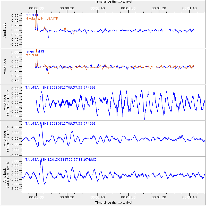
Signal To Noise
| Channel | StoN | STA | LTA |
| TA:L48A: :BHZ:20130812T09:57:33.97499Z | 8.296026 | 2.8563768E-6 | 3.443066E-7 |
| TA:L48A: :BHN:20130812T09:57:33.97499Z | 4.588195 | 1.7155555E-6 | 3.7390643E-7 |
| TA:L48A: :BHE:20130812T09:57:33.97499Z | 1.0211059 | 2.7776593E-7 | 2.720246E-7 |
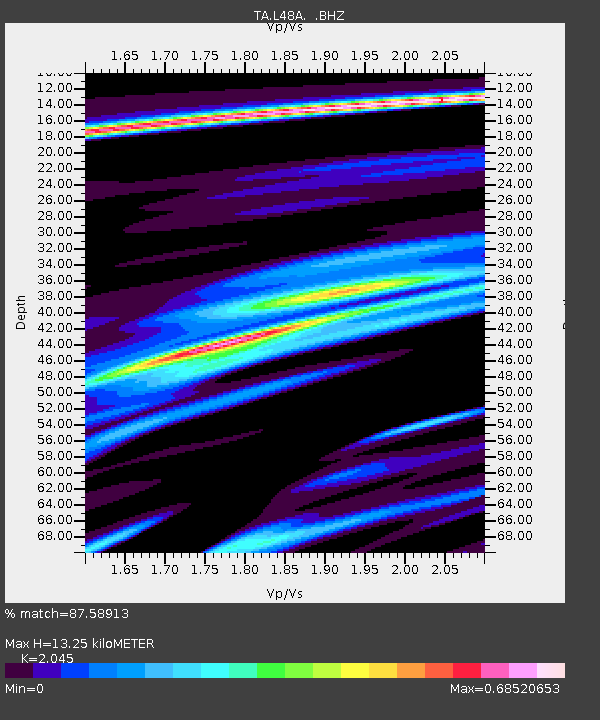
| Arrivals | |
| Ps | 2.3 SECOND |
| PpPs | 5.9 SECOND |
| PsPs/PpSs | 8.1 SECOND |

