You are here: Home > Network List > PF - Volcanologic Network of Piton de Fournaise-OVPF Stations List
> Station HIM cratere Himiltrude > Earthquake Result Viewer
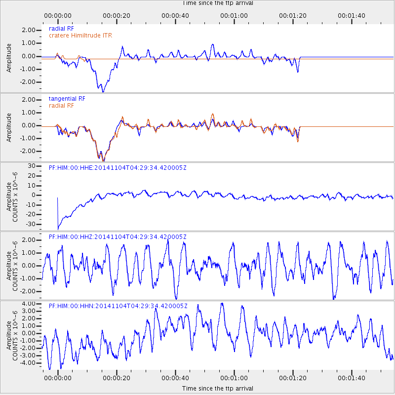
HIM cratere Himiltrude - Earthquake Result Viewer
*The percent match for this event was below the threshold and hence no stack was calculated.
| Earthquake location: |
Minahassa Peninsula, Sulawesi |
| Earthquake latitude/longitude: |
0.0/123.7 |
| Earthquake time(UTC): |
2014/11/04 (308) 04:19:11 GMT |
| Earthquake Depth: |
138 km |
| Earthquake Magnitude: |
4.9 MW, 5.0 mb |
| Earthquake Catalog/Contributor: |
ISC/ISC |
|
| Network: |
PF Volcanologic Network of Piton de Fournaise-OVPF |
| Station: |
HIM cratere Himiltrude |
| Lat/Lon: |
21.21 S/55.72 E |
| Elevation: |
1958 m |
|
| Distance: |
69.5 deg |
| Az: |
247.407 deg |
| Baz: |
81.684 deg |
| Ray Param: |
$rayparam |
*The percent match for this event was below the threshold and hence was not used in the summary stack. |
|
| Radial Match: |
12.064956 % |
| Radial Bump: |
400 |
| Transverse Match: |
11.357363 % |
| Transverse Bump: |
400 |
| SOD ConfigId: |
3390531 |
| Insert Time: |
2019-04-14 20:46:25.689 +0000 |
| GWidth: |
2.5 |
| Max Bumps: |
400 |
| Tol: |
0.001 |
|
Signal To Noise
| Channel | StoN | STA | LTA |
| PF:HIM:00:HHZ:20141104T04:29:34.420005Z | 0.8142517 | 1.060969E-6 | 1.3029988E-6 |
| PF:HIM:00:HHN:20141104T04:29:34.420005Z | 0.9411085 | 6.943777E-6 | 7.378296E-6 |
| PF:HIM:00:HHE:20141104T04:29:34.420005Z | 0.9680495 | 9.932108E-6 | 1.0259917E-5 |
| Arrivals |
| Ps | |
| PpPs | |
| PsPs/PpSs | |


