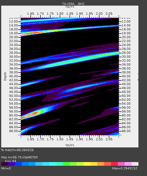
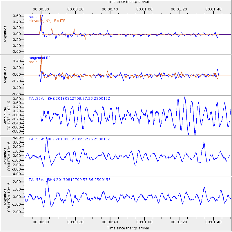
L55A Hinsdale, NY, USA - Earthquake Result Viewer

Earthquake location: Near Coast Of Northern Peru
Earthquake latitude/longitude: -5.4/-81.9
Earthquake time(UTC): 2013/08/12 (224) 09:49:32 GMT
Earthquake Depth: 10 km
Earthquake Magnitude: 6.2 MWW, 6.1 MWB, 6.2 MWW, 6.2 MWC, 6.3 MWC
Earthquake Catalog/Contributor: NEIC PDE/NEIC COMCAT
Network: TA USArray Transportable Network (new EarthScope stations)
Station: L55A Hinsdale, NY, USA
Lat/Lon: 42.18 N/78.44 W
Elevation: 633 m
Distance: 47.5 deg
Az: 3.521 deg
Baz: 184.718 deg
Ray Param: 0.06997596
Estimated Moho Depth: 59.75 km
Estimated Crust Vp/Vs: 1.64
Assumed Crust Vp: 6.419 km/s
Estimated Crust Vs: 3.914 km/s
Estimated Crust Poisson's Ratio: 0.20
Radial Match: 86.064026 %
Radial Bump: 297
Transverse Match: 63.03683 %
Transverse Bump: 400
SOD ConfigId: 626651
Insert Time: 2014-04-17 23:29:06.397 +0000
GWidth: 2.5
Max Bumps: 400
Tol: 0.001

Signal To Noise

ChannelStoNSTALTA
TA:L55A: :BHZ:20130812T09:57:36.250015Z7.94370131.9170143E-62.4132507E-7
TA:L55A: :BHN:20130812T09:57:36.250015Z5.61845731.1591475E-62.0631065E-7
TA:L55A: :BHE:20130812T09:57:36.250015Z0.726053242.1492754E-72.9602174E-7
Arrivals
Ps6.4 SECOND
PpPs23 SECOND
PsPs/PpSs29 SECOND