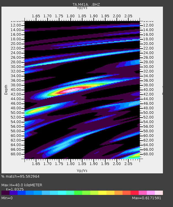
M41A Milan, IL, USA - Earthquake Result Viewer
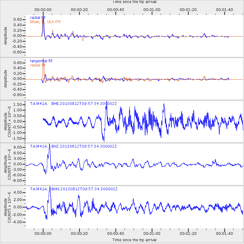
Earthquake location: Near Coast Of Northern Peru
Earthquake latitude/longitude: -5.4/-81.9
Earthquake time(UTC): 2013/08/12 (224) 09:49:32 GMT
Earthquake Depth: 10 km
Earthquake Magnitude: 6.2 MWW, 6.1 MWB, 6.2 MWW, 6.2 MWC, 6.3 MWC
Earthquake Catalog/Contributor: NEIC PDE/NEIC COMCAT
Network: TA USArray Transportable Network (new EarthScope stations)
Station: M41A Milan, IL, USA
Lat/Lon: 41.38 N/90.54 W
Elevation: 226 m
Distance: 47.2 deg
Az: 351.163 deg
Baz: 168.273 deg
Ray Param: 0.07014289
Estimated Moho Depth: 40.0 km
Estimated Crust Vp/Vs: 1.83
Assumed Crust Vp: 6.498 km/s
Estimated Crust Vs: 3.546 km/s
Estimated Crust Poisson's Ratio: 0.29
Radial Match: 95.592964 %
Radial Bump: 360
Transverse Match: 80.53517 %
Transverse Bump: 400
SOD ConfigId: 626651
Insert Time: 2014-04-17 23:29:20.108 +0000
GWidth: 2.5
Max Bumps: 400
Tol: 0.001

Signal To Noise

ChannelStoNSTALTA
TA:M41A: :BHZ:20130812T09:57:34.300002Z13.5063194.3318423E-63.2072708E-7
TA:M41A: :BHN:20130812T09:57:34.300002Z10.0559032.4031356E-62.389776E-7
TA:M41A: :BHE:20130812T09:57:34.300002Z3.83404288.4953365E-72.2157646E-7
Arrivals
Ps5.4 SECOND
PpPs16 SECOND
PsPs/PpSs22 SECOND