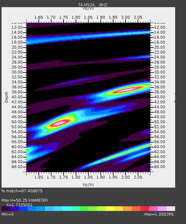
M52A Chesterland, OH, USA - Earthquake Result Viewer
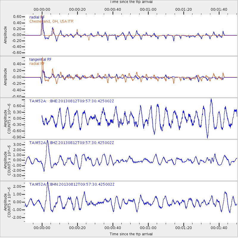
Earthquake location: Near Coast Of Northern Peru
Earthquake latitude/longitude: -5.4/-81.9
Earthquake time(UTC): 2013/08/12 (224) 09:49:32 GMT
Earthquake Depth: 10 km
Earthquake Magnitude: 6.2 MWW, 6.1 MWB, 6.2 MWW, 6.2 MWC, 6.3 MWC
Earthquake Catalog/Contributor: NEIC PDE/NEIC COMCAT
Network: TA USArray Transportable Network (new EarthScope stations)
Station: M52A Chesterland, OH, USA
Lat/Lon: 41.54 N/81.36 W
Elevation: 382 m
Distance: 46.7 deg
Az: 0.588 deg
Baz: 180.779 deg
Ray Param: 0.07047297
Estimated Moho Depth: 50.25 km
Estimated Crust Vp/Vs: 1.73
Assumed Crust Vp: 6.483 km/s
Estimated Crust Vs: 3.742 km/s
Estimated Crust Poisson's Ratio: 0.25
Radial Match: 87.406975 %
Radial Bump: 359
Transverse Match: 69.12985 %
Transverse Bump: 400
SOD ConfigId: 626651
Insert Time: 2014-04-17 23:29:42.461 +0000
GWidth: 2.5
Max Bumps: 400
Tol: 0.001

Signal To Noise

ChannelStoNSTALTA
TA:M52A: :BHZ:20130812T09:57:30.425002Z3.7010631.8425256E-64.978369E-7
TA:M52A: :BHN:20130812T09:57:30.425002Z3.25955061.2032019E-63.6913121E-7
TA:M52A: :BHE:20130812T09:57:30.425002Z0.864480562.3602185E-72.7302158E-7
Arrivals
Ps6.1 SECOND
PpPs20 SECOND
PsPs/PpSs26 SECOND