MSTX Muleshoe, TX, USA - Earthquake Result Viewer
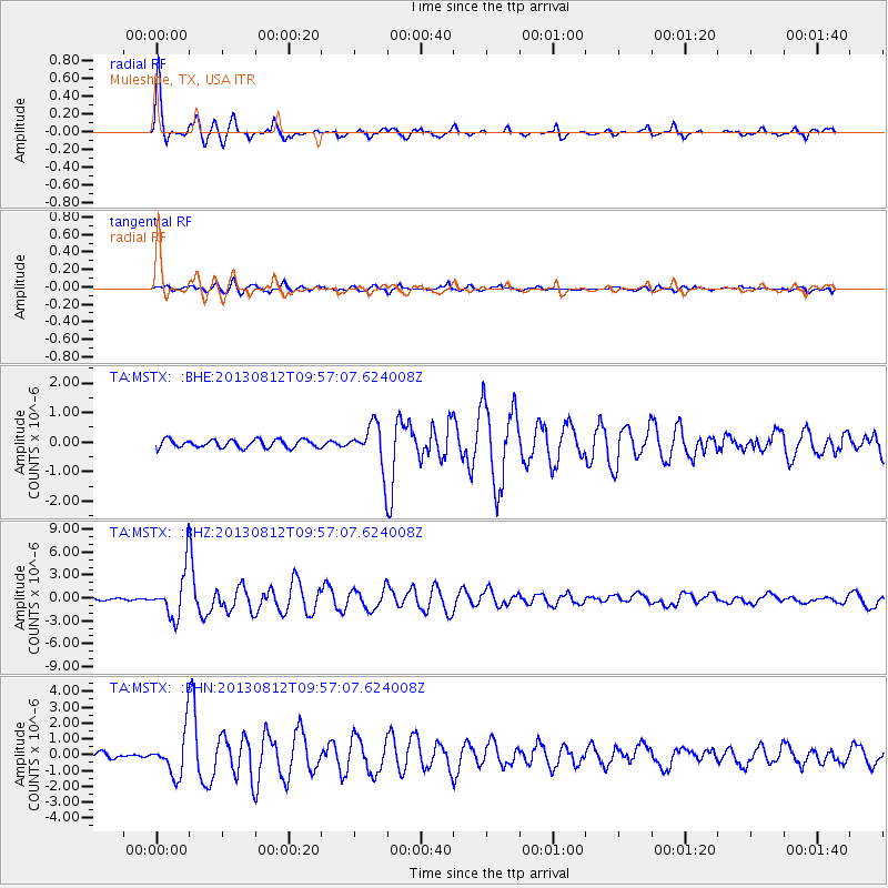
Earthquake location: Near Coast Of Northern Peru
Earthquake latitude/longitude: -5.4/-81.9
Earthquake time(UTC): 2013/08/12 (224) 09:49:32 GMT
Earthquake Depth: 10 km
Earthquake Magnitude: 6.2 MWW, 6.1 MWB, 6.2 MWW, 6.2 MWC, 6.3 MWC
Earthquake Catalog/Contributor: NEIC PDE/NEIC COMCAT
Network: TA USArray Transportable Network (new EarthScope stations)
Station: MSTX Muleshoe, TX, USA
Lat/Lon: 33.97 N/102.77 W
Elevation: 1167 m
Distance: 43.8 deg
Az: 334.723 deg
Baz: 149.234 deg
Ray Param: 0.07229276
Estimated Moho Depth: 65.5 km
Estimated Crust Vp/Vs: 2.04
Assumed Crust Vp: 6.129 km/s
Estimated Crust Vs: 3.004 km/s
Estimated Crust Poisson's Ratio: 0.34
Radial Match: 92.28426 %
Radial Bump: 376
Transverse Match: 68.215515 %
Transverse Bump: 400
SOD ConfigId: 626651
Insert Time: 2014-04-17 23:30:09.162 +0000
GWidth: 2.5
Max Bumps: 400
Tol: 0.001

Signal To Noise

ChannelStoNSTALTA
TA:MSTX: :BHZ:20130812T09:57:07.624008Z24.528253.0226636E-61.2323193E-7
TA:MSTX: :BHN:20130812T09:57:07.624008Z4.61308671.3710613E-62.9721127E-7
TA:MSTX: :BHE:20130812T09:57:07.624008Z5.25918537.2372427E-71.3761148E-7
Arrivals
Ps12 SECOND
PpPs31 SECOND
PsPs/PpSs43 SECOND