N49A Columbus Grove, OH, USA - Earthquake Result Viewer
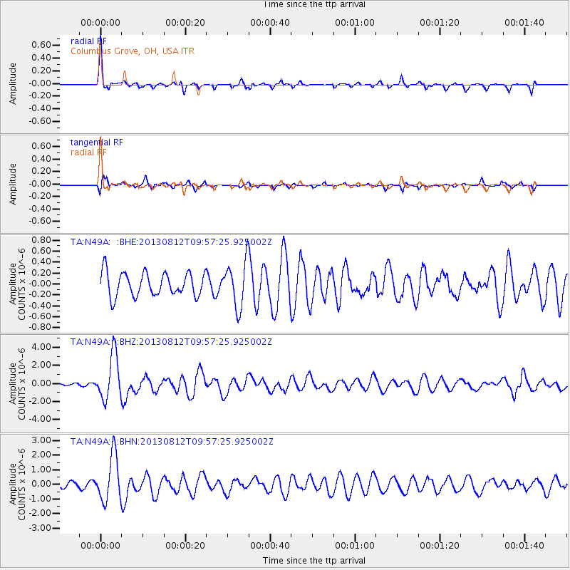
Earthquake location: Near Coast Of Northern Peru
Earthquake latitude/longitude: -5.4/-81.9
Earthquake time(UTC): 2013/08/12 (224) 09:49:32 GMT
Earthquake Depth: 10 km
Earthquake Magnitude: 6.2 MWW, 6.1 MWB, 6.2 MWW, 6.2 MWC, 6.3 MWC
Earthquake Catalog/Contributor: NEIC PDE/NEIC COMCAT
Network: TA USArray Transportable Network (new EarthScope stations)
Station: N49A Columbus Grove, OH, USA
Lat/Lon: 40.92 N/84.18 W
Elevation: 225 m
Distance: 46.1 deg
Az: 357.629 deg
Baz: 176.884 deg
Ray Param: 0.070829906
Estimated Moho Depth: 31.5 km
Estimated Crust Vp/Vs: 2.10
Assumed Crust Vp: 6.498 km/s
Estimated Crust Vs: 3.098 km/s
Estimated Crust Poisson's Ratio: 0.35
Radial Match: 82.50635 %
Radial Bump: 319
Transverse Match: 77.46672 %
Transverse Bump: 387
SOD ConfigId: 626651
Insert Time: 2014-04-17 23:30:28.127 +0000
GWidth: 2.5
Max Bumps: 400
Tol: 0.001

Signal To Noise

ChannelStoNSTALTA
TA:N49A: :BHZ:20130812T09:57:25.925002Z10.565272.5683726E-62.4309577E-7
TA:N49A: :BHN:20130812T09:57:25.925002Z6.5076751.6003307E-62.4591435E-7
TA:N49A: :BHE:20130812T09:57:25.925002Z2.00539524.307486E-72.1479488E-7
Arrivals
Ps5.6 SECOND
PpPs14 SECOND
PsPs/PpSs20 SECOND