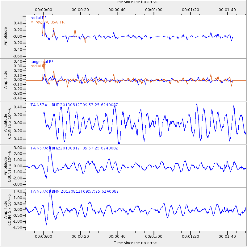
N57A Milroy, PA, USA - Earthquake Result Viewer
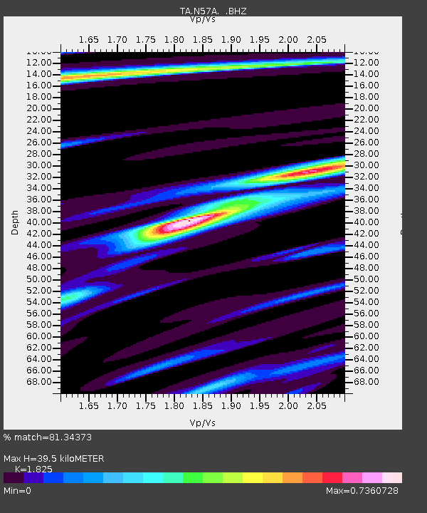
Earthquake location: Near Coast Of Northern Peru
Earthquake latitude/longitude: -5.4/-81.9
Earthquake time(UTC): 2013/08/12 (224) 09:49:32 GMT
Earthquake Depth: 10 km
Earthquake Magnitude: 6.2 MWW, 6.1 MWB, 6.2 MWW, 6.2 MWC, 6.3 MWC
Earthquake Catalog/Contributor: NEIC PDE/NEIC COMCAT
Network: TA USArray Transportable Network (new EarthScope stations)
Station: N57A Milroy, PA, USA
Lat/Lon: 40.76 N/77.55 W
Elevation: 306 m
Distance: 46.1 deg
Az: 4.614 deg
Baz: 186.052 deg
Ray Param: 0.07085292
Estimated Moho Depth: 39.5 km
Estimated Crust Vp/Vs: 1.83
Assumed Crust Vp: 6.121 km/s
Estimated Crust Vs: 3.354 km/s
Estimated Crust Poisson's Ratio: 0.29
Radial Match: 81.34373 %
Radial Bump: 367
Transverse Match: 61.65777 %
Transverse Bump: 400
SOD ConfigId: 626651
Insert Time: 2014-04-17 23:30:48.120 +0000
GWidth: 2.5
Max Bumps: 400
Tol: 0.001

Signal To Noise

ChannelStoNSTALTA
TA:N57A: :BHZ:20130812T09:57:25.624008Z7.30293561.6588771E-62.271521E-7
TA:N57A: :BHN:20130812T09:57:25.624008Z4.7841149.2718057E-71.9380404E-7
TA:N57A: :BHE:20130812T09:57:25.624008Z0.684225561.439778E-72.1042446E-7
Arrivals
Ps5.6 SECOND
PpPs17 SECOND
PsPs/PpSs23 SECOND