
O48A Farmland, IN, USA - Earthquake Result Viewer
| ||||||||||||||||||
| ||||||||||||||||||
| ||||||||||||||||||
|
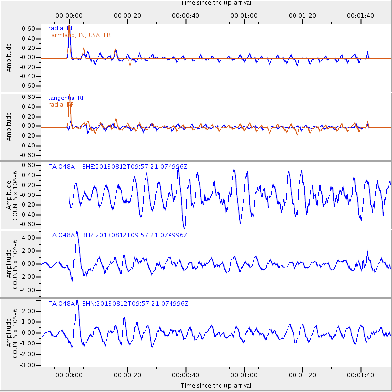
Signal To Noise
| Channel | StoN | STA | LTA |
| TA:O48A: :BHZ:20130812T09:57:21.074996Z | 8.055852 | 2.2224513E-6 | 2.7588035E-7 |
| TA:O48A: :BHN:20130812T09:57:21.074996Z | 4.41159 | 1.3807168E-6 | 3.1297483E-7 |
| TA:O48A: :BHE:20130812T09:57:21.074996Z | 0.99573326 | 1.6875227E-7 | 1.6947537E-7 |
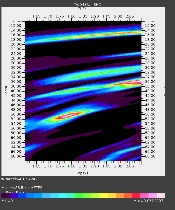
| Arrivals | |
| Ps | 6.3 SECOND |
| PpPs | 16 SECOND |
| PsPs/PpSs | 22 SECOND |

