O52A Adamsville, OH, USA - Earthquake Result Viewer
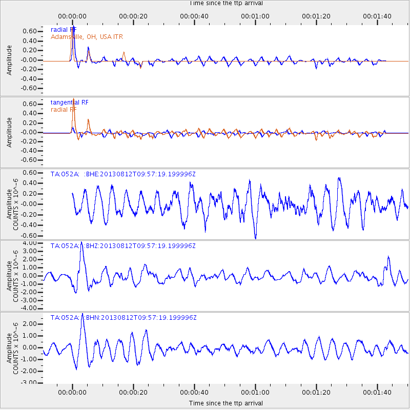
Earthquake location: Near Coast Of Northern Peru
Earthquake latitude/longitude: -5.4/-81.9
Earthquake time(UTC): 2013/08/12 (224) 09:49:32 GMT
Earthquake Depth: 10 km
Earthquake Magnitude: 6.2 MWW, 6.1 MWB, 6.2 MWW, 6.2 MWC, 6.3 MWC
Earthquake Catalog/Contributor: NEIC PDE/NEIC COMCAT
Network: TA USArray Transportable Network (new EarthScope stations)
Station: O52A Adamsville, OH, USA
Lat/Lon: 40.12 N/81.84 W
Elevation: 331 m
Distance: 45.3 deg
Az: 0.098 deg
Baz: 180.127 deg
Ray Param: 0.071378045
Estimated Moho Depth: 38.0 km
Estimated Crust Vp/Vs: 1.85
Assumed Crust Vp: 6.483 km/s
Estimated Crust Vs: 3.504 km/s
Estimated Crust Poisson's Ratio: 0.29
Radial Match: 81.73617 %
Radial Bump: 326
Transverse Match: 63.30764 %
Transverse Bump: 400
SOD ConfigId: 626651
Insert Time: 2014-04-17 23:31:20.308 +0000
GWidth: 2.5
Max Bumps: 400
Tol: 0.001

Signal To Noise

ChannelStoNSTALTA
TA:O52A: :BHZ:20130812T09:57:19.199996Z5.38997941.9185E-63.5593825E-7
TA:O52A: :BHN:20130812T09:57:19.199996Z3.66080281.372837E-63.7500985E-7
TA:O52A: :BHE:20130812T09:57:19.199996Z0.757710641.4651484E-71.9336515E-7
Arrivals
Ps5.3 SECOND
PpPs16 SECOND
PsPs/PpSs21 SECOND