
P53A Whipple, OH, USA - Earthquake Result Viewer
| ||||||||||||||||||
| ||||||||||||||||||
| ||||||||||||||||||
|
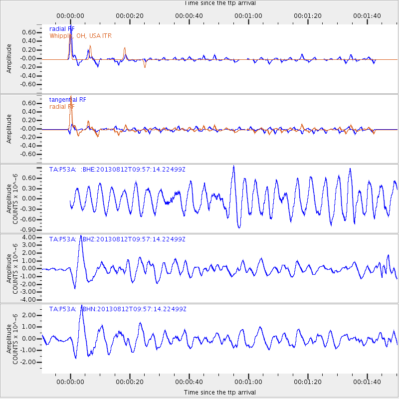
Signal To Noise
| Channel | StoN | STA | LTA |
| TA:P53A: :BHZ:20130812T09:57:14.22499Z | 5.3465233 | 2.016892E-6 | 3.7723433E-7 |
| TA:P53A: :BHN:20130812T09:57:14.22499Z | 6.798915 | 1.332864E-6 | 1.9604072E-7 |
| TA:P53A: :BHE:20130812T09:57:14.22499Z | 0.5284151 | 1.4177435E-7 | 2.683011E-7 |
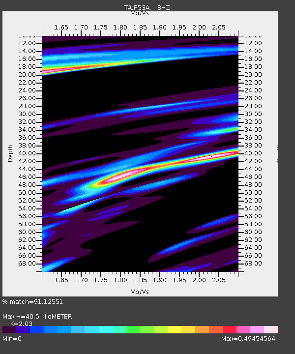
| Arrivals | |
| Ps | 7.1 SECOND |
| PpPs | 19 SECOND |
| PsPs/PpSs | 26 SECOND |

