POKR Poker Plat Research Range, AK, USA - Earthquake Result Viewer
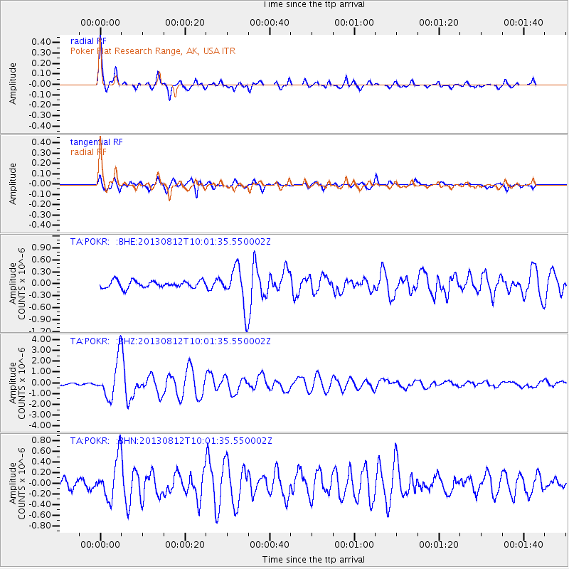
Earthquake location: Near Coast Of Northern Peru
Earthquake latitude/longitude: -5.4/-81.9
Earthquake time(UTC): 2013/08/12 (224) 09:49:32 GMT
Earthquake Depth: 10 km
Earthquake Magnitude: 6.2 MWW, 6.1 MWB, 6.2 MWW, 6.2 MWC, 6.3 MWC
Earthquake Catalog/Contributor: NEIC PDE/NEIC COMCAT
Network: TA USArray Transportable Network (new EarthScope stations)
Station: POKR Poker Plat Research Range, AK, USA
Lat/Lon: 65.12 N/147.43 W
Elevation: 501 m
Distance: 84.8 deg
Az: 337.258 deg
Baz: 114.533 deg
Ray Param: 0.045196645
Estimated Moho Depth: 34.5 km
Estimated Crust Vp/Vs: 1.70
Assumed Crust Vp: 6.566 km/s
Estimated Crust Vs: 3.862 km/s
Estimated Crust Poisson's Ratio: 0.24
Radial Match: 92.12217 %
Radial Bump: 400
Transverse Match: 89.98616 %
Transverse Bump: 400
SOD ConfigId: 626651
Insert Time: 2014-04-17 23:32:23.367 +0000
GWidth: 2.5
Max Bumps: 400
Tol: 0.001

Signal To Noise

ChannelStoNSTALTA
TA:POKR: :BHZ:20130812T10:01:35.550002Z22.899321.8215087E-67.954422E-8
TA:POKR: :BHN:20130812T10:01:35.550002Z5.03303153.9710952E-77.890067E-8
TA:POKR: :BHE:20130812T10:01:35.550002Z6.11348535.2139967E-78.528681E-8
Arrivals
Ps3.8 SECOND
PpPs14 SECOND
PsPs/PpSs18 SECOND