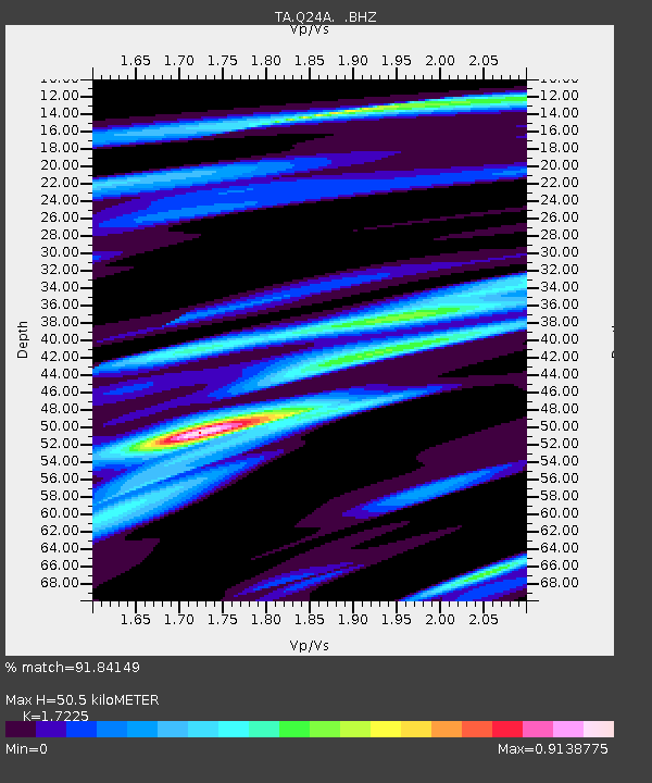
Q24A Divide, CO, USA - Earthquake Result Viewer
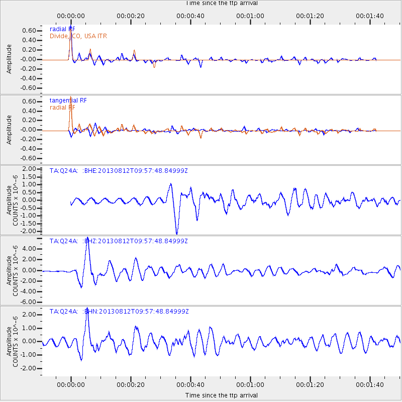
Earthquake location: Near Coast Of Northern Peru
Earthquake latitude/longitude: -5.4/-81.9
Earthquake time(UTC): 2013/08/12 (224) 09:49:32 GMT
Earthquake Depth: 10 km
Earthquake Magnitude: 6.2 MWW, 6.1 MWB, 6.2 MWW, 6.2 MWC, 6.3 MWC
Earthquake Catalog/Contributor: NEIC PDE/NEIC COMCAT
Network: TA USArray Transportable Network (new EarthScope stations)
Station: Q24A Divide, CO, USA
Lat/Lon: 38.96 N/105.15 W
Elevation: 2775 m
Distance: 49.1 deg
Az: 336.001 deg
Baz: 148.707 deg
Ray Param: 0.0689224
Estimated Moho Depth: 50.5 km
Estimated Crust Vp/Vs: 1.72
Assumed Crust Vp: 6.159 km/s
Estimated Crust Vs: 3.575 km/s
Estimated Crust Poisson's Ratio: 0.25
Radial Match: 91.84149 %
Radial Bump: 355
Transverse Match: 86.82366 %
Transverse Bump: 400
SOD ConfigId: 626651
Insert Time: 2014-04-17 23:32:25.336 +0000
GWidth: 2.5
Max Bumps: 400
Tol: 0.001

Signal To Noise

ChannelStoNSTALTA
TA:Q24A: :BHZ:20130812T09:57:48.84999Z14.6475211.4077658E-69.6109495E-8
TA:Q24A: :BHN:20130812T09:57:48.84999Z6.10670236.315365E-71.03416944E-7
TA:Q24A: :BHE:20130812T09:57:48.84999Z3.99640945.274892E-71.3199077E-7
Arrivals
Ps6.3 SECOND
PpPs21 SECOND
PsPs/PpSs27 SECOND