R51A Hillsboro, KY, USA - Earthquake Result Viewer
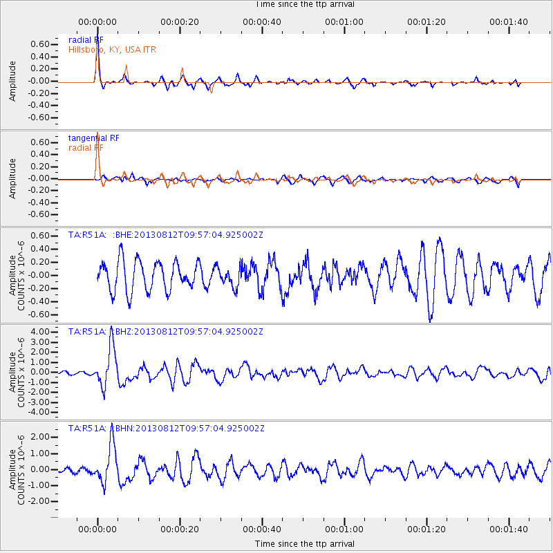
Earthquake location: Near Coast Of Northern Peru
Earthquake latitude/longitude: -5.4/-81.9
Earthquake time(UTC): 2013/08/12 (224) 09:49:32 GMT
Earthquake Depth: 10 km
Earthquake Magnitude: 6.2 MWW, 6.1 MWB, 6.2 MWW, 6.2 MWC, 6.3 MWC
Earthquake Catalog/Contributor: NEIC PDE/NEIC COMCAT
Network: TA USArray Transportable Network (new EarthScope stations)
Station: R51A Hillsboro, KY, USA
Lat/Lon: 38.30 N/83.58 W
Elevation: 231 m
Distance: 43.5 deg
Az: 358.106 deg
Baz: 177.604 deg
Ray Param: 0.0725123
Estimated Moho Depth: 49.75 km
Estimated Crust Vp/Vs: 1.75
Assumed Crust Vp: 6.232 km/s
Estimated Crust Vs: 3.551 km/s
Estimated Crust Poisson's Ratio: 0.26
Radial Match: 87.28144 %
Radial Bump: 294
Transverse Match: 59.64652 %
Transverse Bump: 397
SOD ConfigId: 626651
Insert Time: 2014-04-17 23:33:11.877 +0000
GWidth: 2.5
Max Bumps: 400
Tol: 0.001

Signal To Noise

ChannelStoNSTALTA
TA:R51A: :BHZ:20130812T09:57:04.925002Z13.7561742.0406724E-61.4834592E-7
TA:R51A: :BHN:20130812T09:57:04.925002Z8.5295091.2337651E-61.4464669E-7
TA:R51A: :BHE:20130812T09:57:04.925002Z0.662046971.490725E-72.2516907E-7
Arrivals
Ps6.4 SECOND
PpPs21 SECOND
PsPs/PpSs27 SECOND