
R59A King George, VA, USA - Earthquake Result Viewer
| ||||||||||||||||||
| ||||||||||||||||||
| ||||||||||||||||||
|
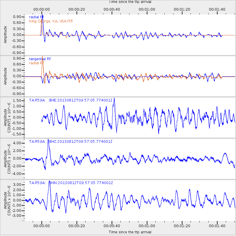
Signal To Noise
| Channel | StoN | STA | LTA |
| TA:R59A: :BHZ:20130812T09:57:05.774001Z | 12.423702 | 2.127934E-6 | 1.7128019E-7 |
| TA:R59A: :BHN:20130812T09:57:05.774001Z | 4.156712 | 1.6057593E-6 | 3.8630515E-7 |
| TA:R59A: :BHE:20130812T09:57:05.774001Z | 1.3337008 | 5.0922296E-7 | 3.8181201E-7 |
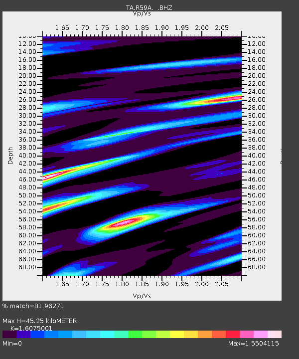
| Arrivals | |
| Ps | 4.6 SECOND |
| PpPs | 17 SECOND |
| PsPs/PpSs | 22 SECOND |

