
S44A Carbondale, IL, USA - Earthquake Result Viewer
| ||||||||||||||||||
| ||||||||||||||||||
| ||||||||||||||||||
|
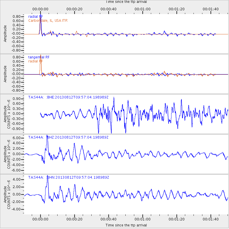
Signal To Noise
| Channel | StoN | STA | LTA |
| TA:S44A: :BHZ:20130812T09:57:04.198989Z | 11.760233 | 2.849897E-6 | 2.4233339E-7 |
| TA:S44A: :BHN:20130812T09:57:04.198989Z | 6.2076783 | 2.053433E-6 | 3.3078922E-7 |
| TA:S44A: :BHE:20130812T09:57:04.198989Z | 2.935646 | 3.8734737E-7 | 1.3194621E-7 |
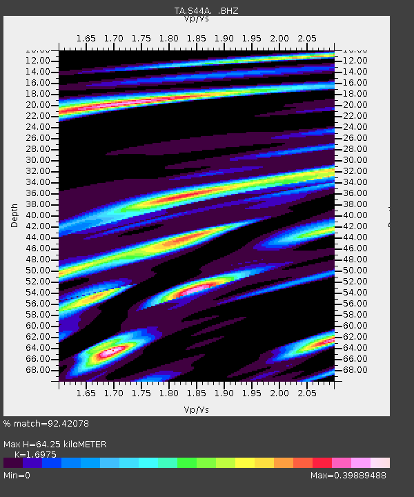
| Arrivals | |
| Ps | 7.5 SECOND |
| PpPs | 25 SECOND |
| PsPs/PpSs | 33 SECOND |

