S50A Richmond, KY, USA - Earthquake Result Viewer
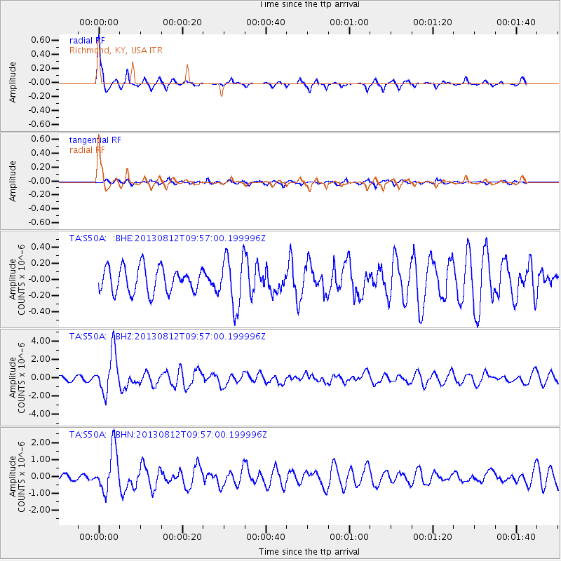
Earthquake location: Near Coast Of Northern Peru
Earthquake latitude/longitude: -5.4/-81.9
Earthquake time(UTC): 2013/08/12 (224) 09:49:32 GMT
Earthquake Depth: 10 km
Earthquake Magnitude: 6.2 MWW, 6.1 MWB, 6.2 MWW, 6.2 MWC, 6.3 MWC
Earthquake Catalog/Contributor: NEIC PDE/NEIC COMCAT
Network: TA USArray Transportable Network (new EarthScope stations)
Station: S50A Richmond, KY, USA
Lat/Lon: 37.68 N/84.40 W
Elevation: 300 m
Distance: 42.9 deg
Az: 357.117 deg
Baz: 176.382 deg
Ray Param: 0.07288555
Estimated Moho Depth: 51.75 km
Estimated Crust Vp/Vs: 1.81
Assumed Crust Vp: 6.476 km/s
Estimated Crust Vs: 3.583 km/s
Estimated Crust Poisson's Ratio: 0.28
Radial Match: 90.240425 %
Radial Bump: 252
Transverse Match: 58.156143 %
Transverse Bump: 400
SOD ConfigId: 626651
Insert Time: 2014-04-17 23:33:55.229 +0000
GWidth: 2.5
Max Bumps: 400
Tol: 0.001

Signal To Noise

ChannelStoNSTALTA
TA:S50A: :BHZ:20130812T09:57:00.199996Z12.0325362.2421543E-61.8634097E-7
TA:S50A: :BHN:20130812T09:57:00.199996Z10.6084161.2855396E-61.211811E-7
TA:S50A: :BHE:20130812T09:57:00.199996Z2.05824833.1965791E-71.5530581E-7
Arrivals
Ps6.9 SECOND
PpPs21 SECOND
PsPs/PpSs28 SECOND