
T50A Nancy, KY, USA - Earthquake Result Viewer
| ||||||||||||||||||
| ||||||||||||||||||
| ||||||||||||||||||
|
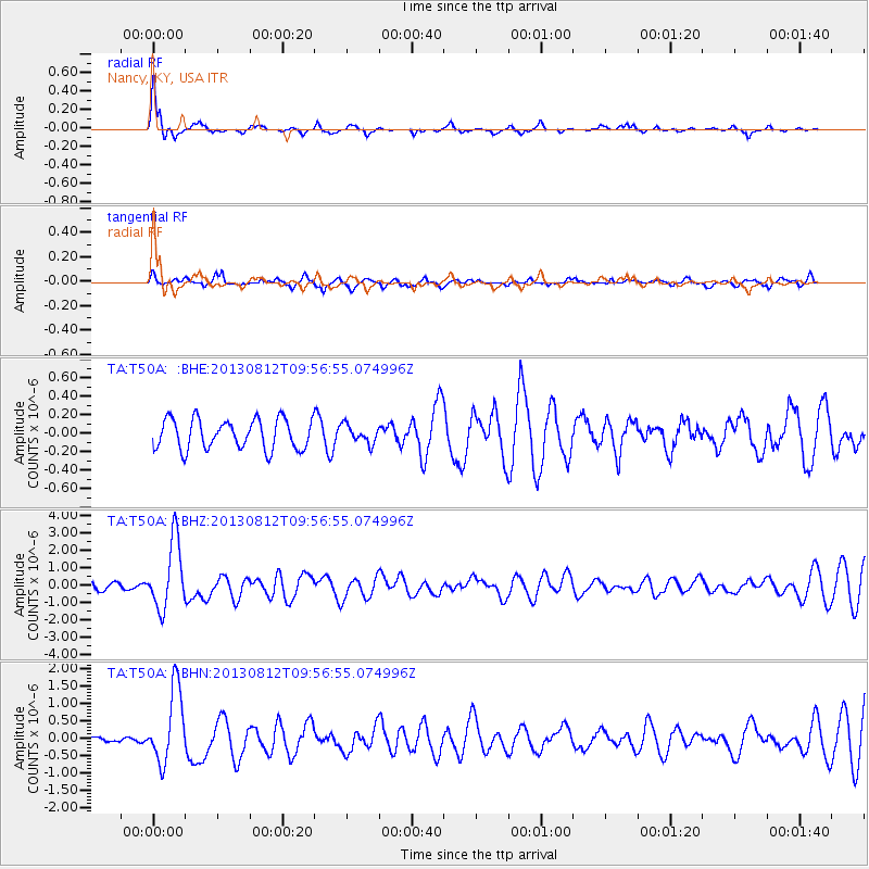
Signal To Noise
| Channel | StoN | STA | LTA |
| TA:T50A: :BHZ:20130812T09:56:55.074996Z | 9.781233 | 1.95338E-6 | 1.9970695E-7 |
| TA:T50A: :BHN:20130812T09:56:55.074996Z | 7.9703584 | 1.0605453E-6 | 1.3306118E-7 |
| TA:T50A: :BHE:20130812T09:56:55.074996Z | 0.6012237 | 9.694304E-8 | 1.6124288E-7 |
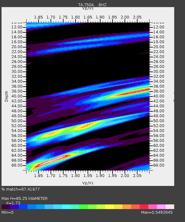
| Arrivals | |
| Ps | 7.8 SECOND |
| PpPs | 26 SECOND |
| PsPs/PpSs | 33 SECOND |

