
T52A Hallie, KY, USA - Earthquake Result Viewer
| ||||||||||||||||||
| ||||||||||||||||||
| ||||||||||||||||||
|
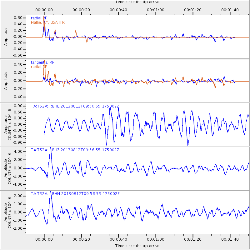
Signal To Noise
| Channel | StoN | STA | LTA |
| TA:T52A: :BHZ:20130812T09:56:55.175002Z | 11.043396 | 2.154204E-6 | 1.9506716E-7 |
| TA:T52A: :BHN:20130812T09:56:55.175002Z | 4.2339735 | 1.2713447E-6 | 3.0027226E-7 |
| TA:T52A: :BHE:20130812T09:56:55.175002Z | 2.0179784 | 4.0446142E-7 | 2.00429E-7 |
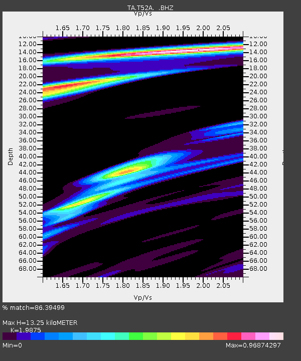
| Arrivals | |
| Ps | 2.1 SECOND |
| PpPs | 5.8 SECOND |
| PsPs/PpSs | 7.9 SECOND |

